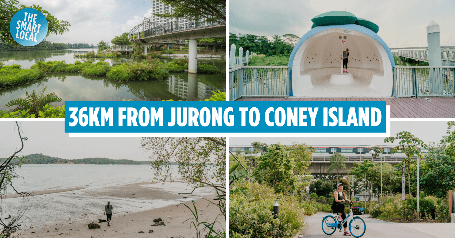
Coast-to-coast trail cycling & walking guide
Nature lovers, if you’ve checked off all the walking and hiking trails and want a challenge, tackle the coast-to-coast (C2C) trail in Singapore’s weather. We took on this task recently and let’s just say that we saw thunderstorms, sunny skies, and grey clouds all within the hour.
And yet we completed the trail to bring you this comprehensive guide on what to expect along the way. You’ll find out what the nicest part of the trail is, where the rest points are, and where you can fill your tummy or take a pee break.
Table of Contents
- Coast-to-coast trail cycling & walking guide
- All you need to know about the coast-to-coast trail
- How long do I need to complete the coast-to-coast trail?
- – Exploring the Coast-to-Coast Central Trail –
- 1. Jurong Lake Gardens
- 2. Bukit Batok Nature Park
- 3. Hindhede Drive
- 4. Adam Road
- 5. Bishan-Ang Mo Kio Park
- 6. Luxus Hills Park
- 7. Sengkang Floating Wetland
- 8. Punggol Waterway Park
- 9. Coney Island
- 10. Rower’s Bay Park
- How to prepare for the coast-to-coast trail?
All you need to know about the coast-to-coast trail
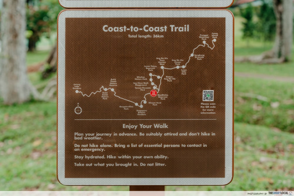
As the name suggests, the coast-to-coast trail brings you from one coastal part of our island to another. There are 3 trails in total, totalling a whopping 123km:
- Central trail: Jurong to Punggol (36km)
- Northern trail: Sungei Buloh Wetland Reserve to Khatib Bongsu Nature Park (25km)
- Southern trail: Tuas to Changi Beach Park (62km)
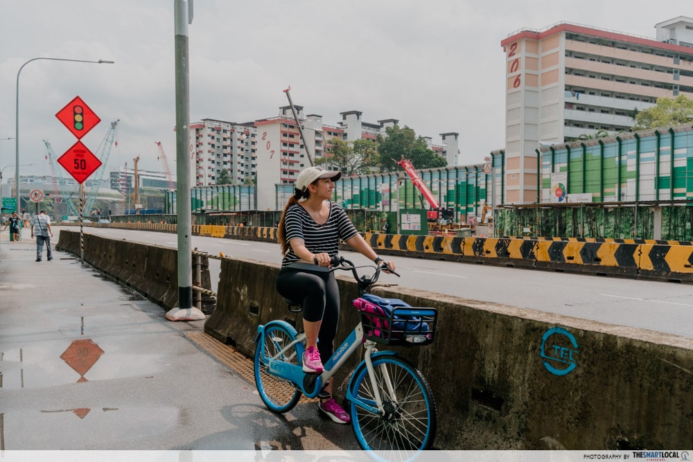
Right now, only the central trail is accessible while the other 2 routes are still in the works and are slated to be ready in 2026. Spoiler alert! Not the entire coast-to-coast trail is along the Park Connector Network (PCN). In fact, the path from Jurong Lake Gardens to Luxus Hills Park is largely adjacent to main roads and you will encounter some construction work on the way.
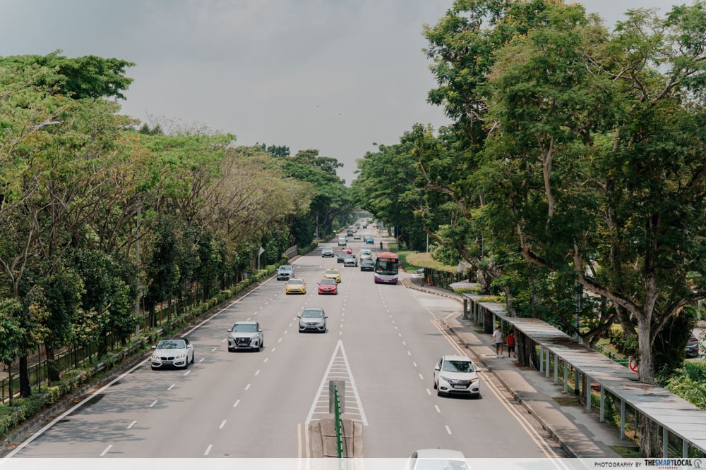
Having said that, when we cycled the path, we found that there were shared sidewalks throughout the route so at no point did we have to cycle on the main road with the cars. You do, however, need to be mindful of pedestrians and slow down when passing through bus stops.
On that note, the great thing about this route is that there are a lot of MRT stations and bus stops; we saw one at almost every kilometre of the way. This means that you can choose to start and end at any point along the route.
Sights near Punggol Waterway Park.
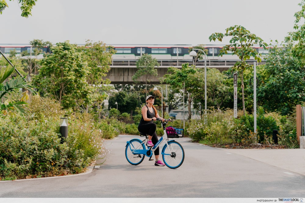
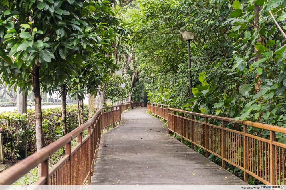
Based on our personal experience, we found that the path from Luxus Hills Park to Coney Island was the more scenic route. It was also smoother as the route is entirely along the PCN with clear signs on where to go. On a weekday afternoon, the parks we passed through were generally quiet and serene, making it a fun cycling route.
Atlas Coffeehouse is on the way from Hindhede Drive to Adam Road.
That’s not to say that the other half of the route isn’t worth exploring. The section between Hindhede Drive and Ang Mo Kio is laden with famous eateries such as Nam Kee Pau, Five Star Chicken Rice, and The Good Burger Stand. So, you can very well make it a food trail and go cafe-hopping with friends.
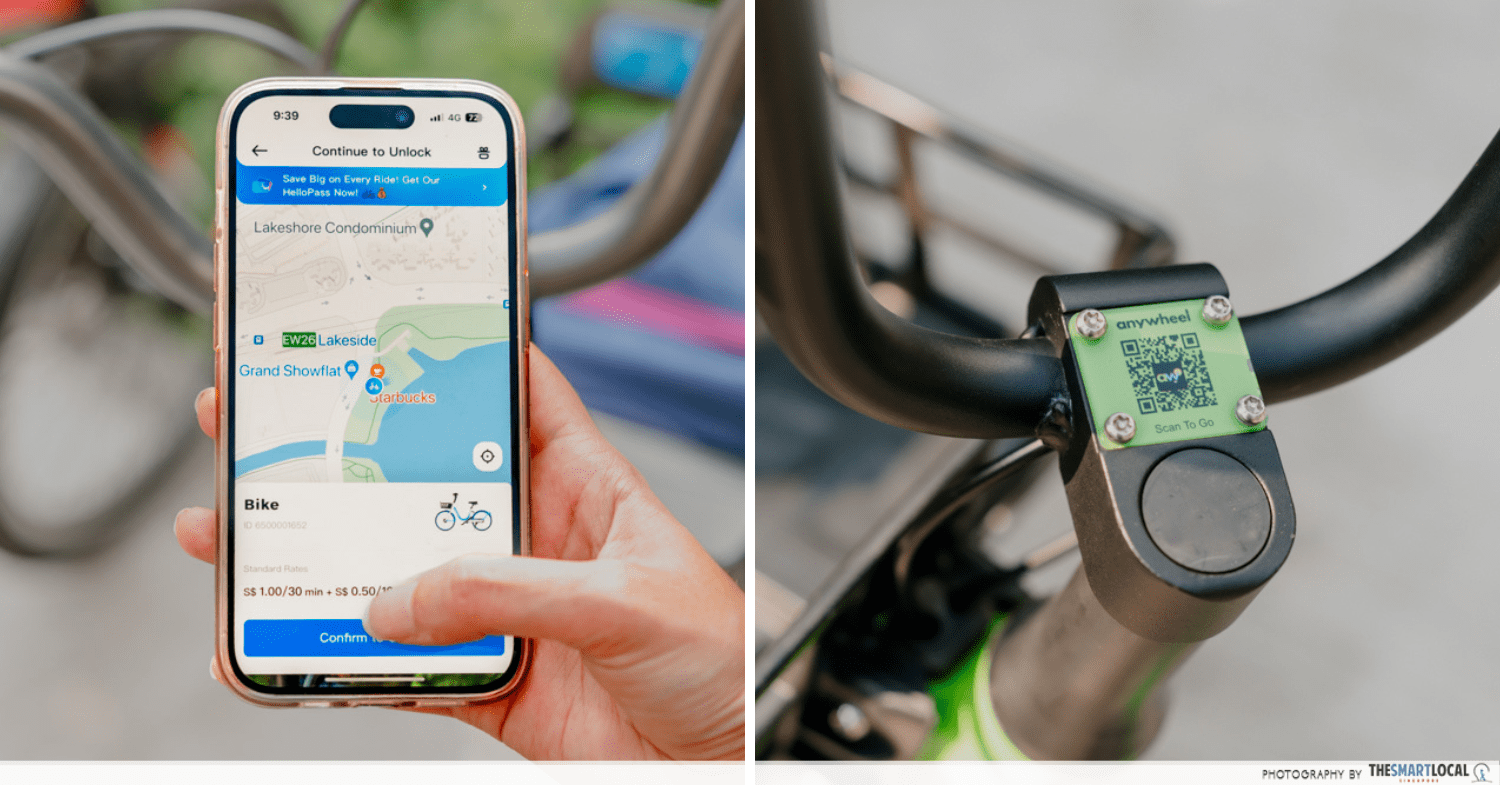
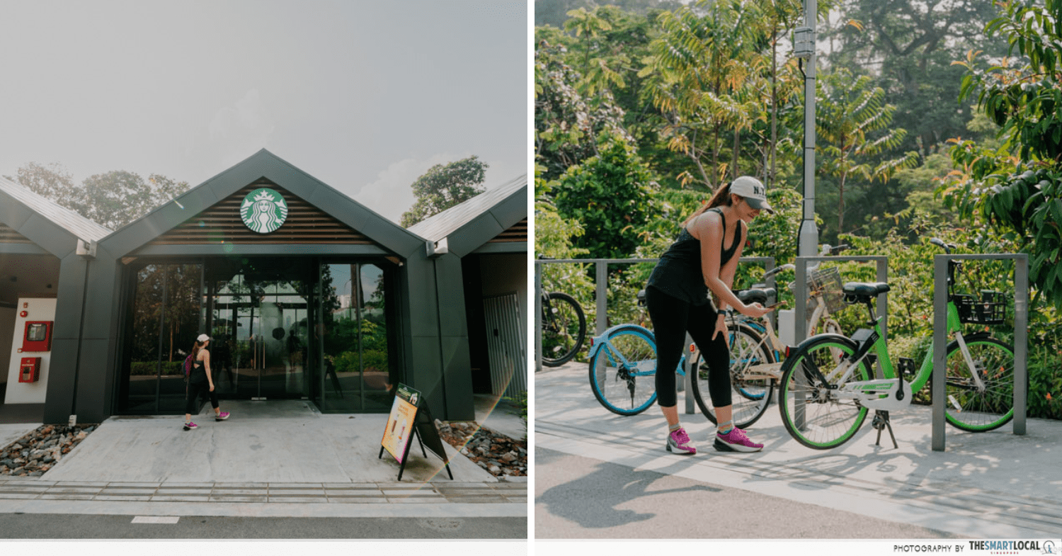
Now, if you’re planning to cycle, you’ve got a couple of options. The most convenient and the cheaper option is to use one of the bike-sharing services – Anywheel (App Store | Google Play) or HelloRide (App Store | Google Play).
A quick look at the app will show that there are plenty of bikes available for rent around the route, making it easy to pick up and drop off whenever you need to stop. Another advantage is that you won’t have to worry about locking the bike as you can just return it and rent a new one once your break is over.
Another option is to rent a bicycle from GoCycling. The advantage of choosing this option is that their mountain bikes have gears, giving you more flexibility on speed and the effort you put into cycling. However, you are then bound to their designated drop-off points and operating hours.
| Bike rental service | Rates | Things to take note of |
| Anywheel | $1 for every 30 minutes |
|
| HelloRide | $1 for first 30 minutes
$0.50 for every subsequent 10 minutes |
|
| GoCycling | $10/hour |
|
How long do I need to complete the coast-to-coast trail?
Before embarking on our adventure, we consulted trusty Google to find out how long it would take to cover the entire coast-to-coast trail.
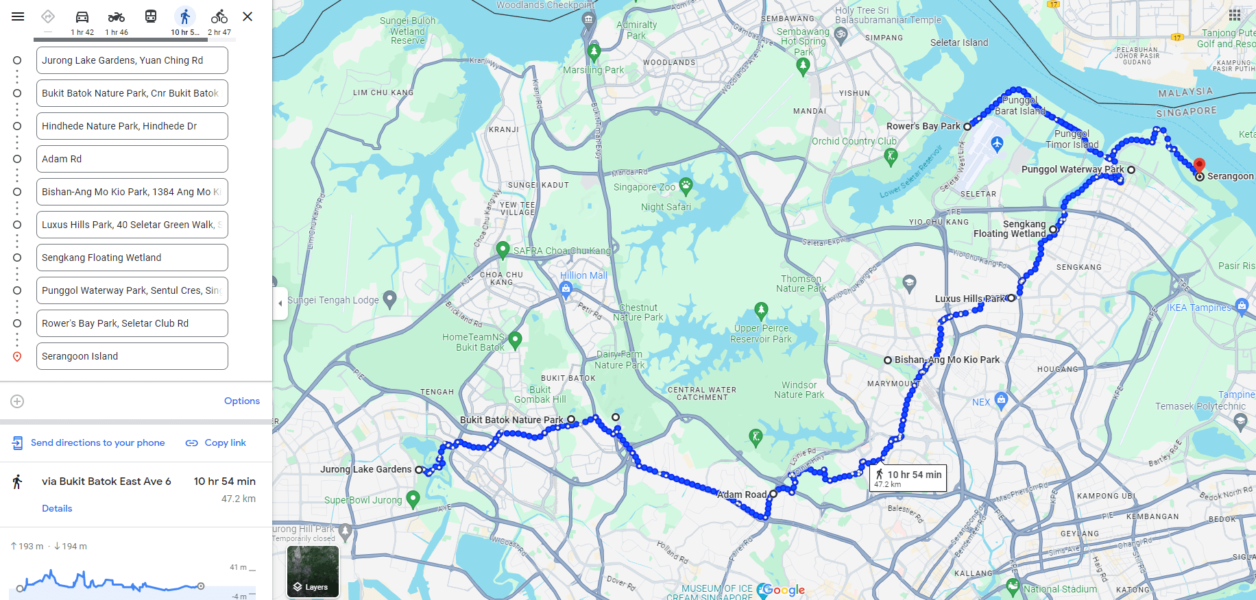
Screenshot from: Google Maps
Well, according to Google Maps, it was going to take us about 11 hours by foot – without stopping along the way. That sounded like quite the mission and so we decided to cycle instead. However, should you be keen to walk, it’s advisable to split the journey into 2 parts to make it more doable.
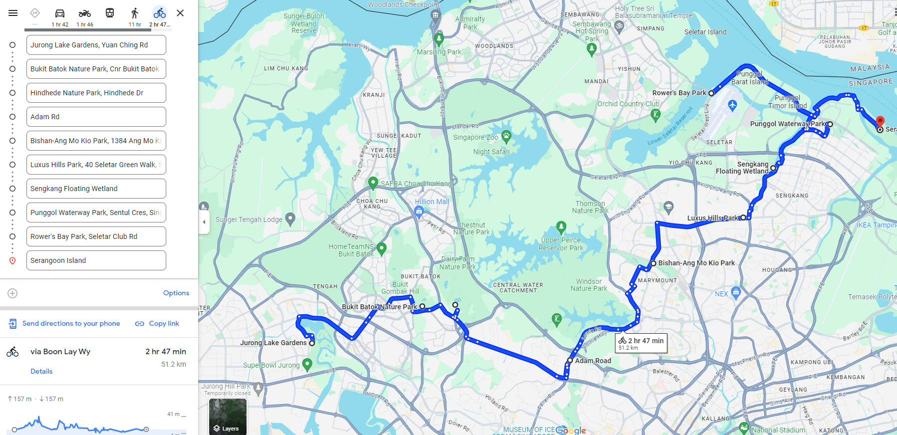
Screenshot from: Google Maps
If you’re a pro cyclist or just really fit, you can probably complete the trail on a bike within 3 hours if you cycle non-stop. However, seeing as how we were 2 average folks with reasonable fitness levels, it took us closer to 5.5 hours to cover the coast-to-coast central trail from one end to the other.
Here’s a tip: use an app like Strava (App Store | Google Play) to track your walk or bike ride so you can see how much ground you covered and how long it actually took to complete.
– Exploring the Coast-to-Coast Central Trail –
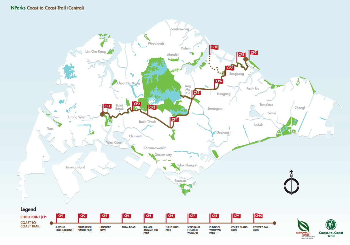
Image credit: NParks
The main coast-to-coast trail brings you through 9 checkpoints starting from Jurong Lake Gardens and ending at Coney Island. There is a bonus 10th checkpoint at Rower’s Bay Park which requires a slight detour from the main path to get to, but more on that later.
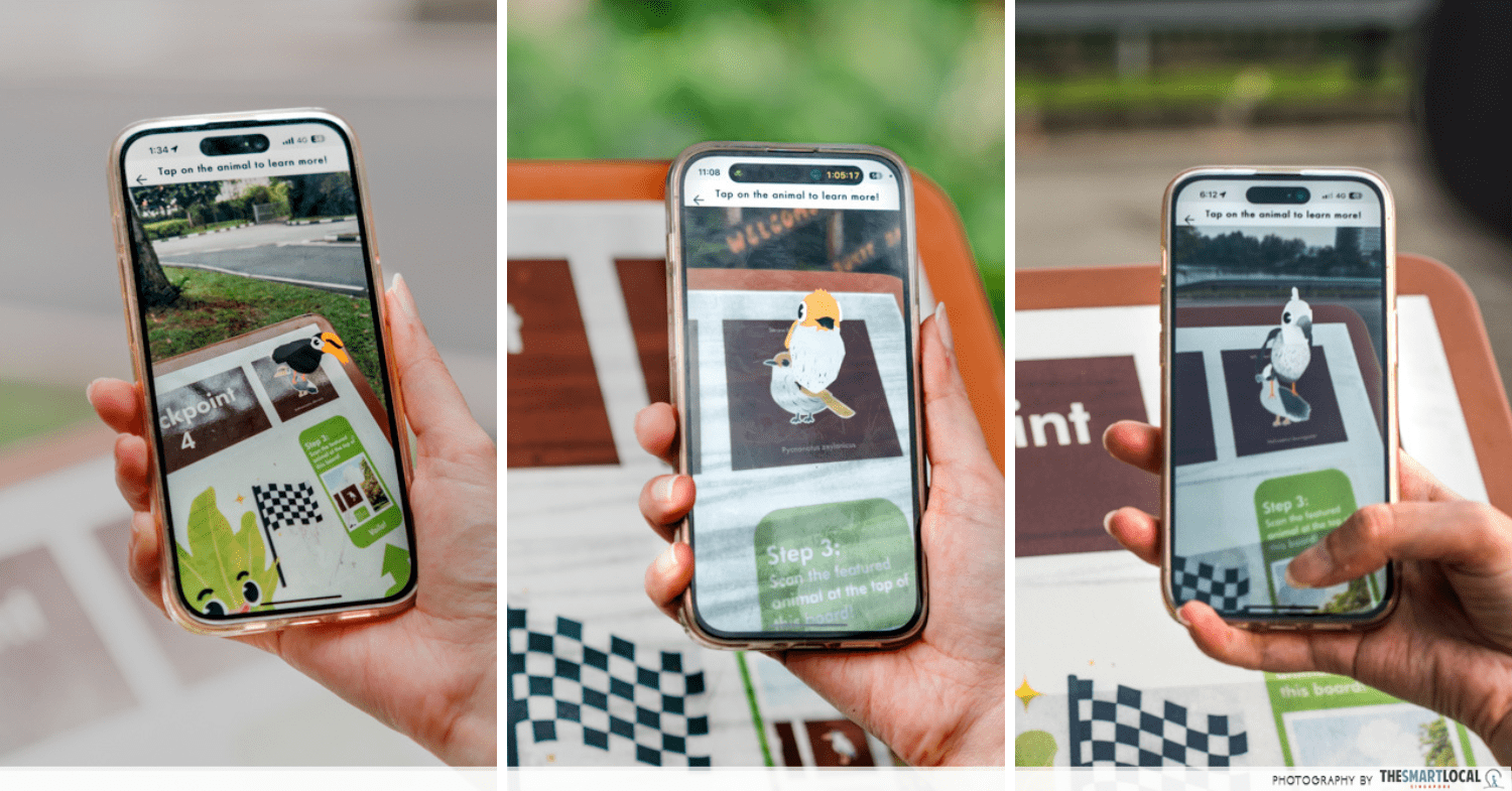
Don’t forget to whip out your phone at each checkpoint and use the Nparks Explore A Route app to see a cute AR bird or animal pop up on your screen.
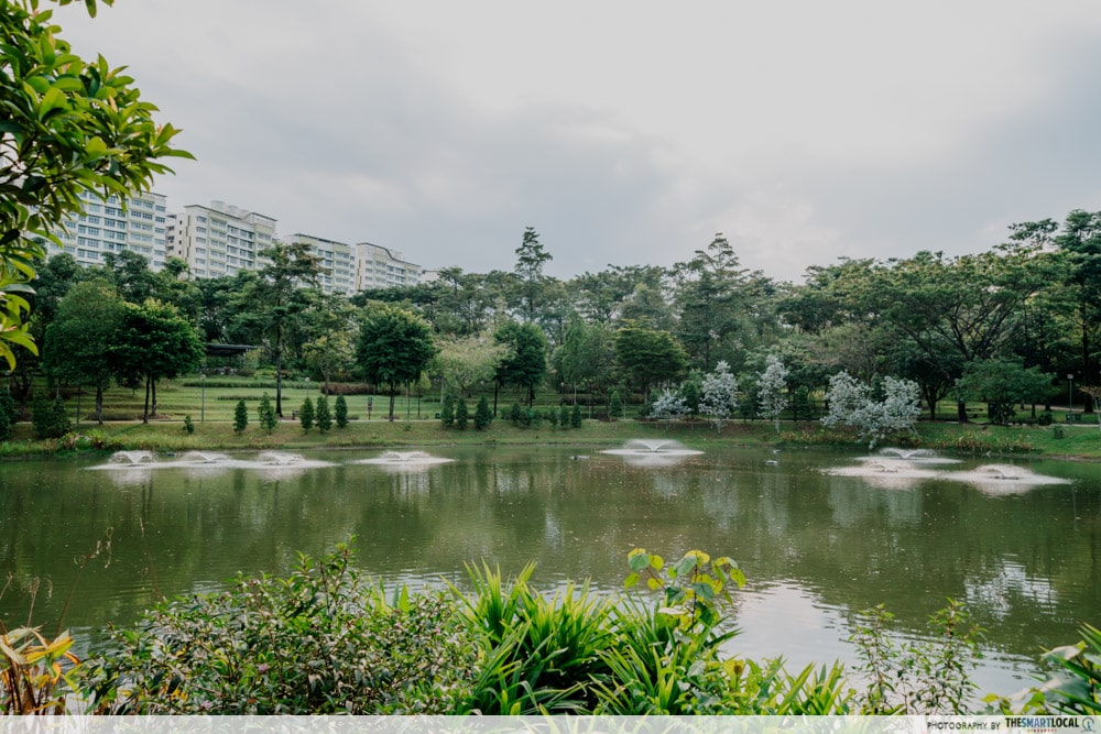
1. Jurong Lake Gardens
We started our journey at Jurong Lake Gardens bright and early at 9am. To be honest, it was already quite sunny and hot by then so in hindsight, we’d recommend starting even earlier if possible. In case this is your first time at the gardens, take some time to explore the photo spots such as the Lalang field and IG-famous lone tree.
A good meeting point would be Lakeside MRT station or if you’d like some breakfast then head to one of the most unique Starbucks in Singapore. This one is located in a lakeside house with glass panels overlooking the lake which looked beautiful covered in morning mist. When you’re done, the bike parking is right outside so you can start your journey straight away.
From here, follow the MRT track and head towards Chinese Garden MRT along Boon Lay Way. Once you reach the junction of Boon Lay Way and Jurong East Central, cross diagonally left to continue along the trail.
At the time of writing, there were some roadworks happening along this road so we had to dismount and wheel the bikes some part of the way. Once you find yourself cycling along the Pandan River, look out for a fork in the road and a C2C sign indicating that Bukit Batok Nature Park is on the right.
The sign isn’t very obvious and we missed it the first time round, having to turn back once we realised we had gone off the path.
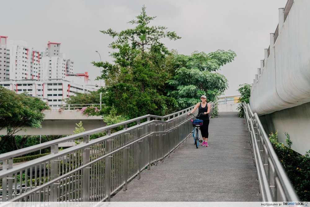
This will then bring you to Toh Guan Flyover which you’ll need to cross over the PIE to continue along Ulu Pandan Park Connector. From here, just follow the canal to Bukit Batok East Avenue 4 and you’ll reach checkpoint 2 in no time.
2. Bukit Batok Nature Park
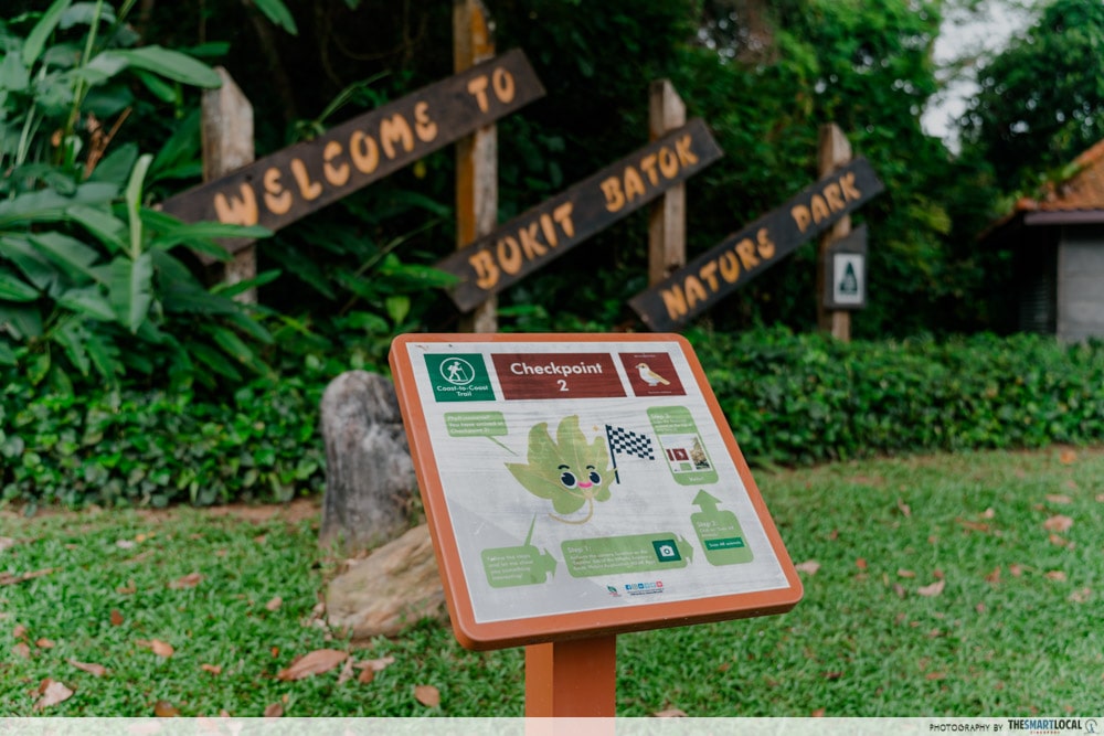
Also known as the “Little Guilin”, Bukit Batok Nature Park is famous for its quarry pool. If you’re walking, you can take this time to hike up the hill to get to this viewpoint but it does require some effort. If not, just continue within the park towards Upper Bukit Timah Road. This is the shortest section of the coast-to-coast trail and it only takes 10 minutes to reach checkpoint 3.
On the day we attempted this trail, it started raining heavily when we reached checkpoint 2. And so we had to seek shelter in the nearby HDB blocks for about 45 minutes before the sky cleared. Luckily, we found a coffee shop to have an early lunch and were re-energised to continue the rest of our journey.
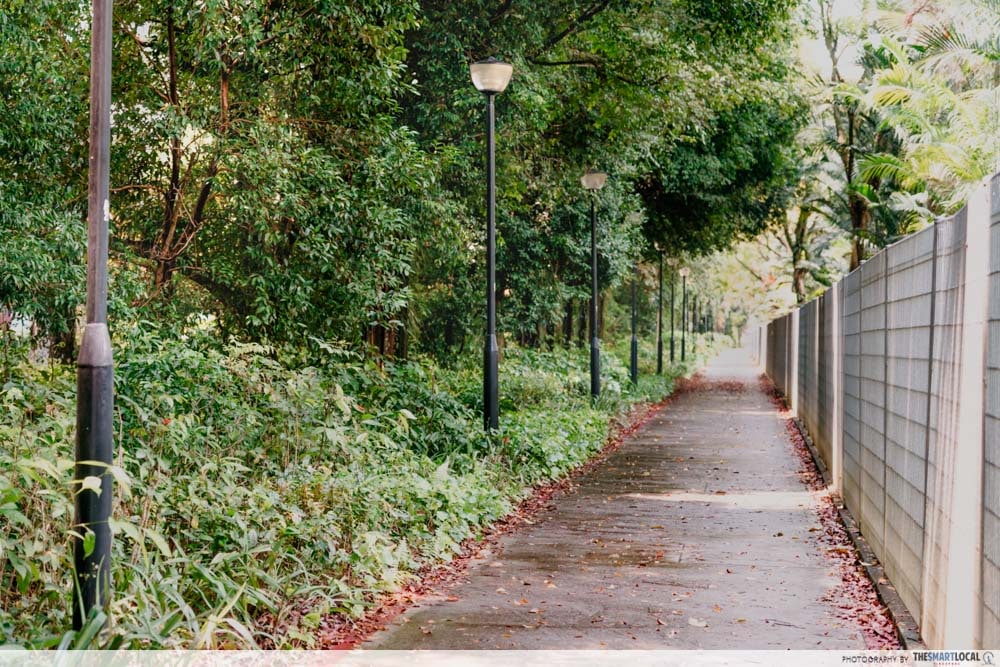
3. Hindhede Drive
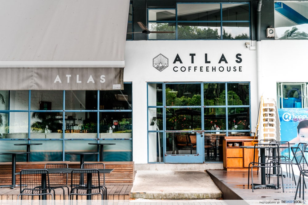
Once you reach Hindhede Drive, you’ll notice that you’re cycling along the Rail Corridor. Here’s where you have numerous food options to consider for a lunch break including Beauty World Centre, Bukit Timah Food Centre, Bukit Timah Plaza, and The Rail Mall.
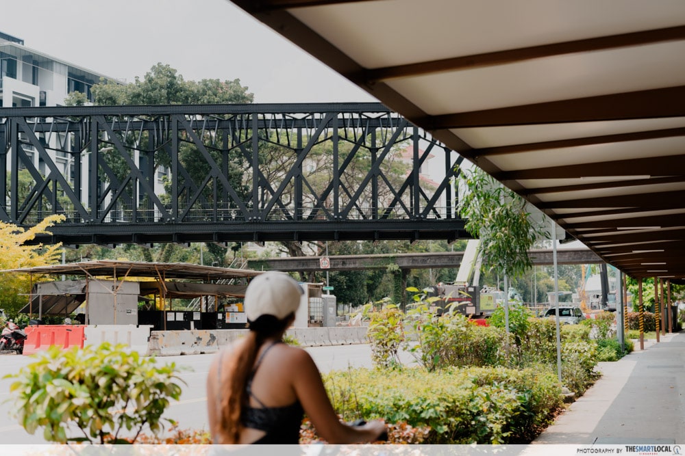
Look out for the iconic Truss Bridge and old railway track as you make your way towards King Albert Park.
From there, it’s a long straight road that passes by Hwa Chong Institution, giving you enough time to realise just how big the school compound is. Upon reaching the junction of Bukit Timah Road and Adam Road, cross diagonally to the left.
4. Adam Road
Checkpoint 4 is really easy to spot. All you need to do is find directions to Adam Road Food Centre. This would be another great spot to take a break and grab a bite if you haven’t yet because the section that follows is the longest part of the coast-to-coast trail.
From here, the distance to Bishan-Ang Mo Kio Park is roughly 8km and mostly goes through residential areas or the highway flyover.
As you continue along Adam Road, you’ll come across this pink building which is the Japanese Association which is your cue to turn right. There’s then an inclined path towards Kheam Hock Park. We found this to be on the steep side and decided to wheel our bikes up instead.
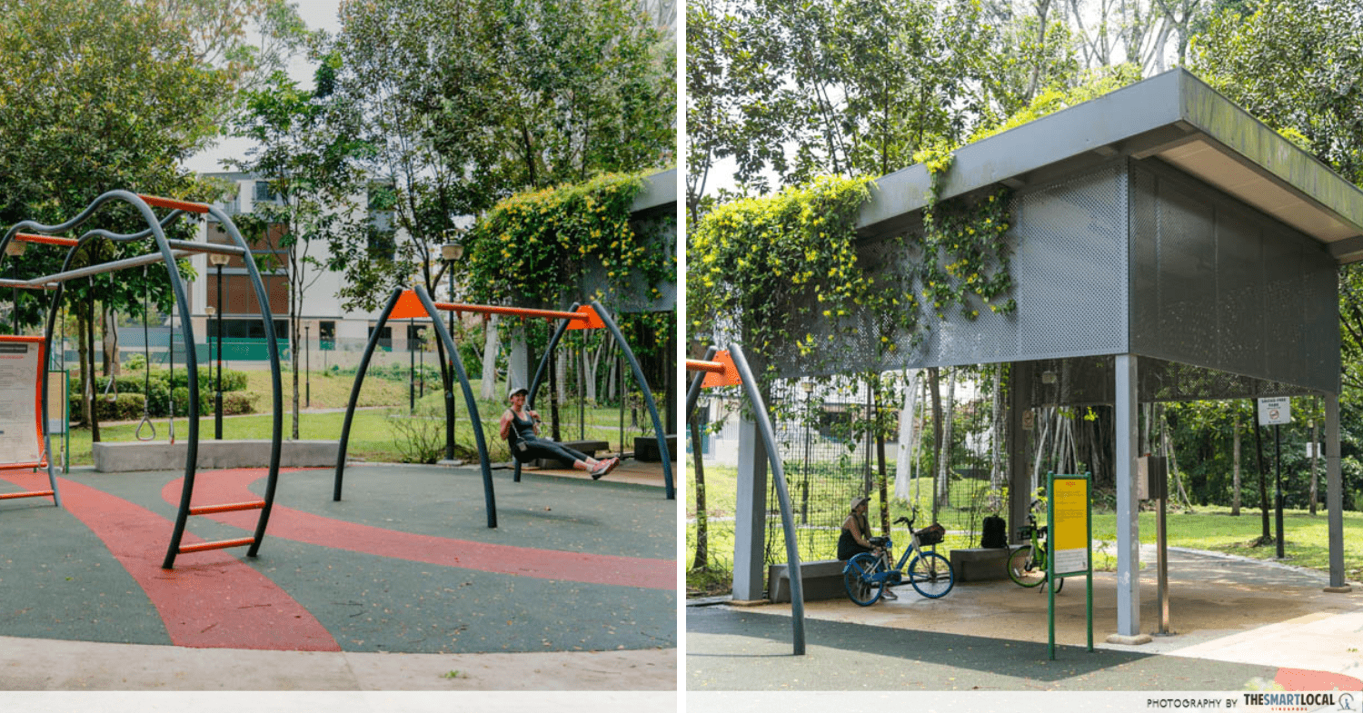
Soon you’ll reach this free fitness corner with monkey bars, swings, and hanging ropes. It started to drizzle slightly when we reached this residential neighbourhood and boy were we glad that there was some shelter to take cover.
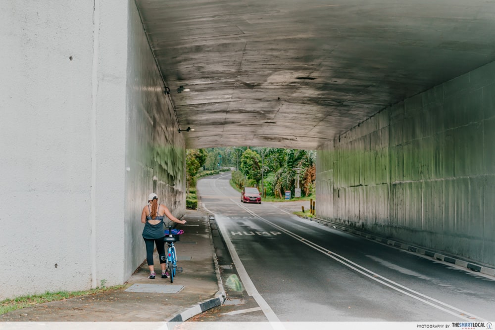
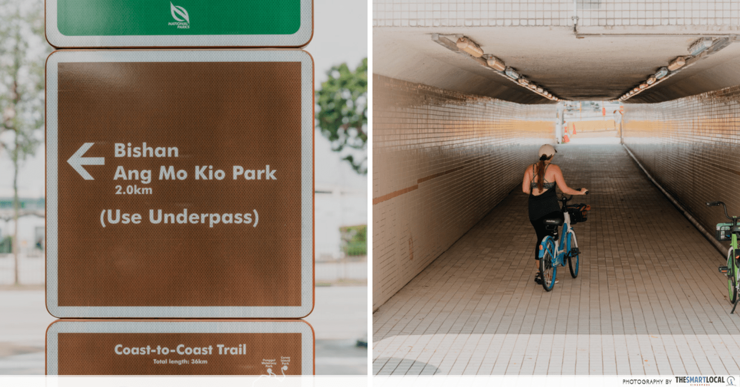
Luckily, it didn’t last that long and soon we were back on track, heading towards Kheam Hock Road. At this point, you’ll need to cross an underpass and pass by Seh Ong Cemetery.
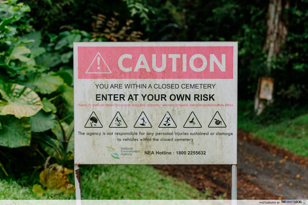
While it may not feature on a list of the most haunted spots in Singapore, the area is spooky even in the day. You’ll pass by a couple of tombstones and signs warning you to enter the closed cemetery at your own risk. NGL, we peddled through this section pretty fast.
Once you’re out of the woods, you’ll hear noises of traffic as you cycle along Lornie Highway towards MacRitchie Reservoir.
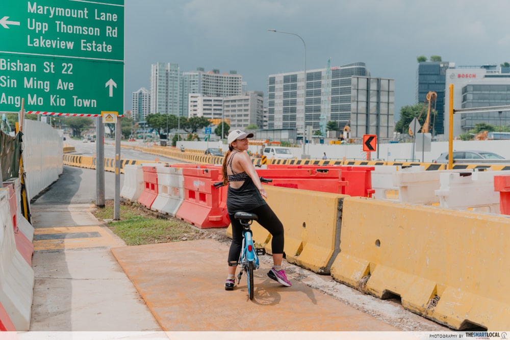
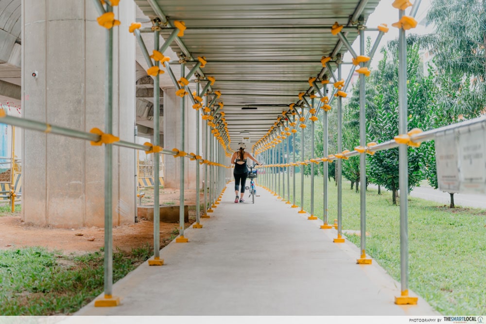
There’s a lot of construction going on around this area so be extra careful when riding or walking. Follow the signs for where the temporary pedestrian pathways are and go at slow speeds.
There’s no need to go into the reservoir although you could if you wanted to make a slight detour. Otherwise, once you’ve passed by MacRitchie Reservoir, turn left on Marymount Road and continue all the way straight to Bishan-Ang Mo Kio Park.
We must admit that this is where we had to call it a day because our photographer started getting leg cramps and didn’t want to risk a muscle pull. So, we returned our bikes at Upper Thomson MRT station, hydrated ourselves from drinks at Thomson Plaza and ended part 1 of the coast-to-coast trail.
5. Bishan-Ang Mo Kio Park
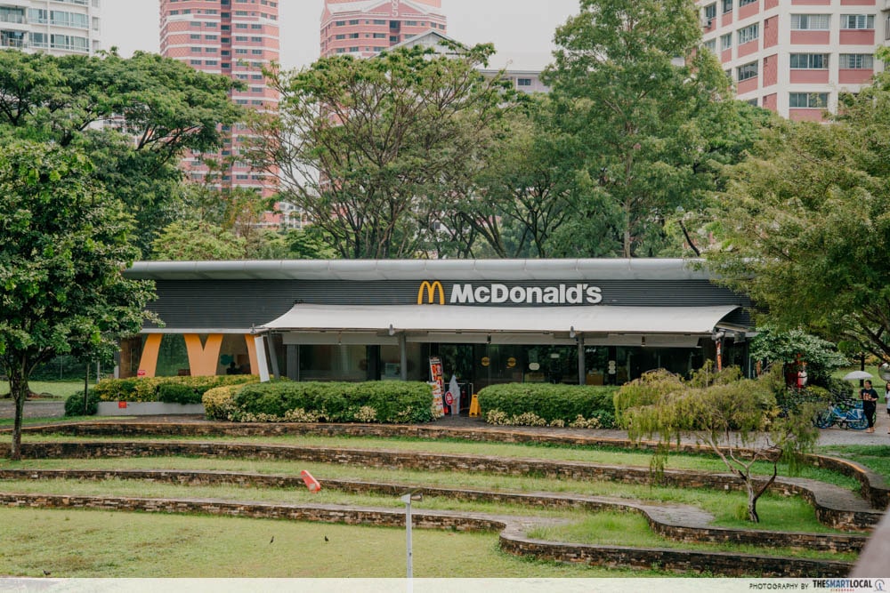
Day 2 began at Bishan-Ang Mo Kio Park. While Queensway McDonald’s may have been dubbed the prettiest one in Singapore, we think the outlet here isn’t too shabby either.
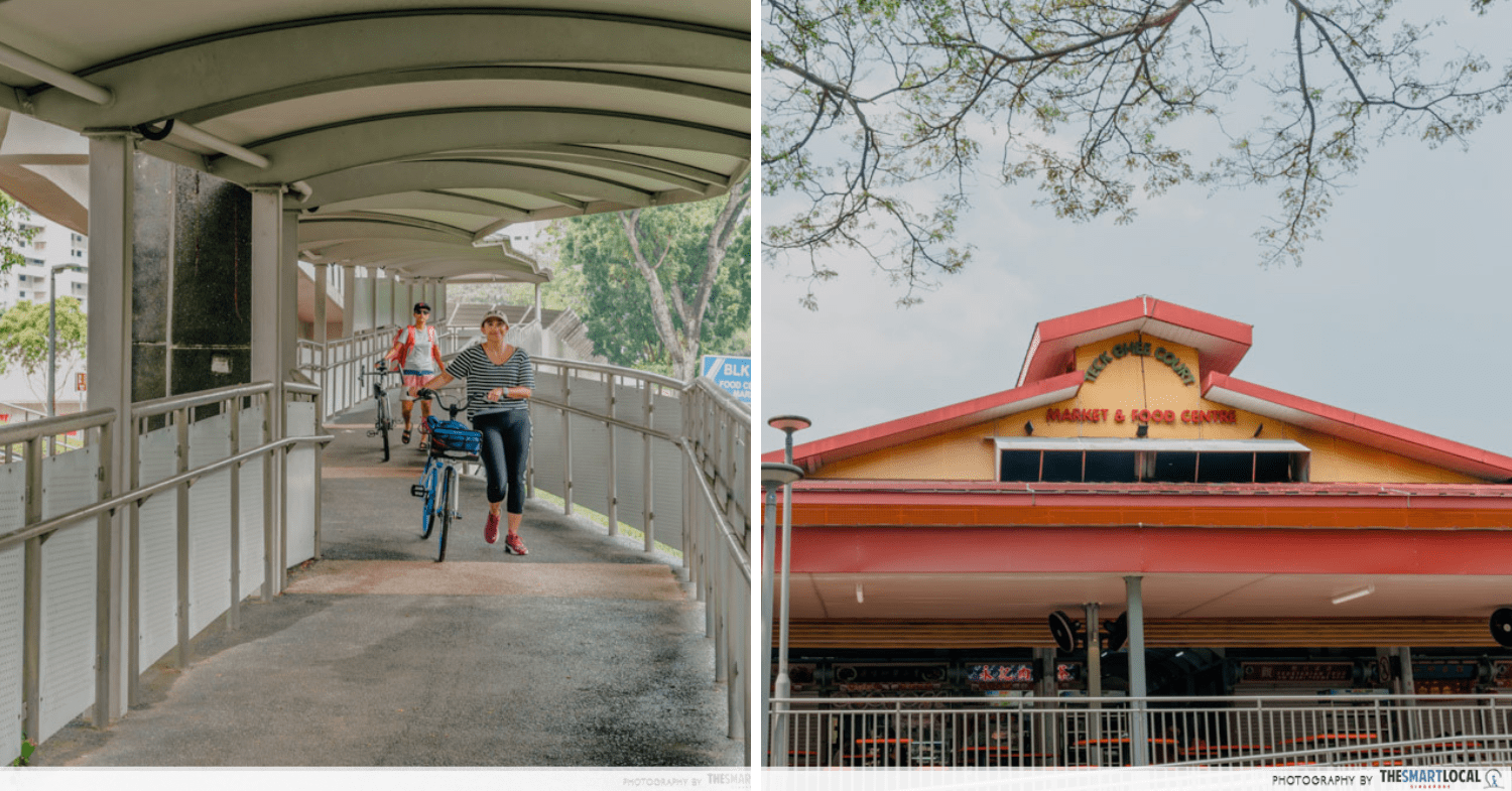
If fast food isn’t your thing, you can also get food and drinks from Teck Ghee Court Market and Food Centre across the park. In fact, you have to cross over anyway to go straight along Ang Mo Kio Avenue 6.
Your only view during this entire stretch is ongoing construction work until you turn right on Ang Mo Kio Avenue 5. Then, it’s a nice long straight road to checkpoint 6. Say hi to the friendly students from Nanyang Polytechnic and ITE College Central as you pass by their schools on the way.
6. Luxus Hills Park
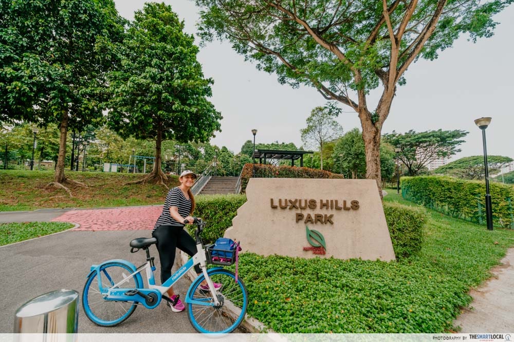
Congratulations, you’ve completed half of the coast-to-coast trail. From this point, it’s a smooth sailing journey till the very end. There are fewer traffic lights, fewer junctions to cross, and hardly any more construction work.
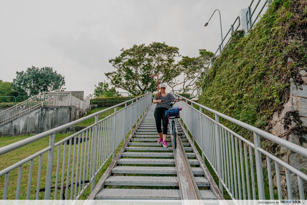
At the end of Ang Mo Kio Avenue 5, turn left onto Yio Chu Kang Road and then cross the road to the right when you see a Shell petrol station. This part is a little tricky as you’ll need to wheel your bike down a steep ramp to get to the canal.
And with that, you’ll find yourself at Kampong Lorong Buangkok – said to be the last kampong remaining in Singapore. It is a residential area so be respectful of the residents’ privacy and don’t go wandering into their homes.
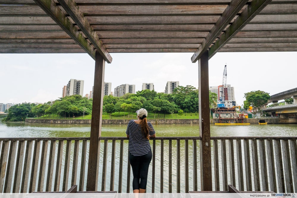
The section from Buangkok towards Sengkang is a quiet, peaceful one. It would have been equally nice to have a leisurely stroll along the river and look at the high-rise apartments along the way. We did stop by a small lookout point to see a sweet uncle feeding bread to a family of turtles.
7. Sengkang Floating Wetland
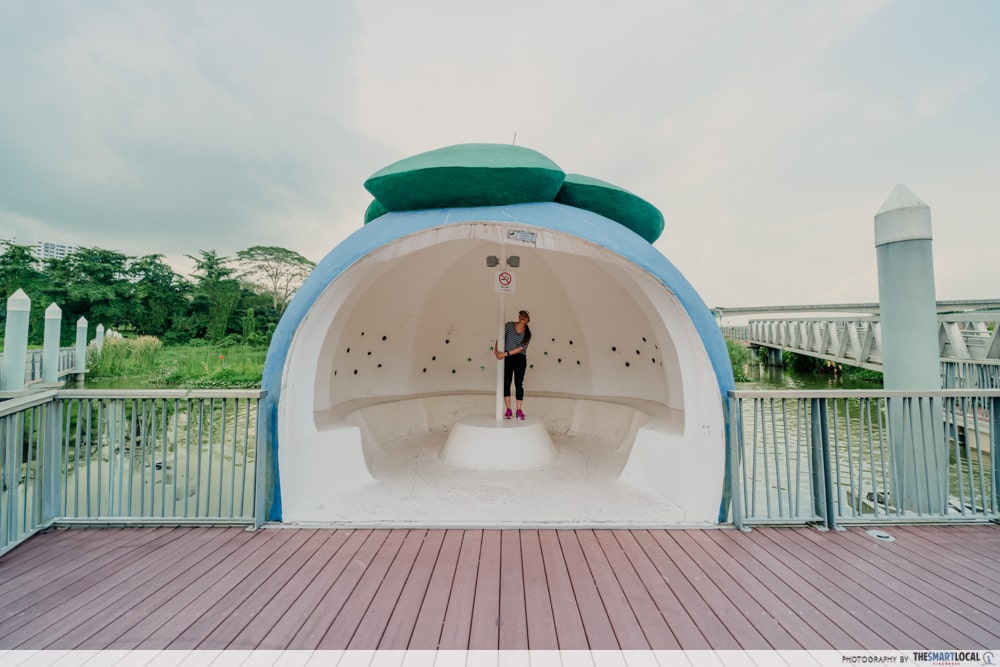
Checkpoint 7 is none other than Sengkang Floating Wetland at Sengkang Riverside Park. You’ve probably come across pictures of the cute mangosteen-shaped shelter and benches resembling larger-than-life slices of oranges. Yup, they’re here. This is probably a good point to give your legs some rest and hydrate.
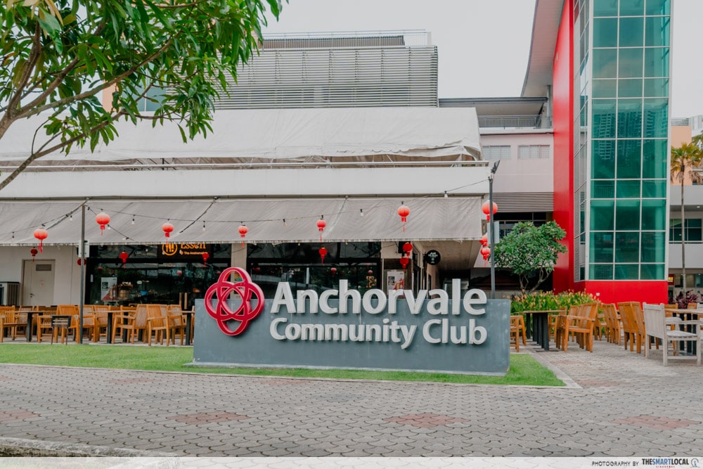
If you need to go to the loo or buy drinks, there’s also Anchorvale Community Club on this path.
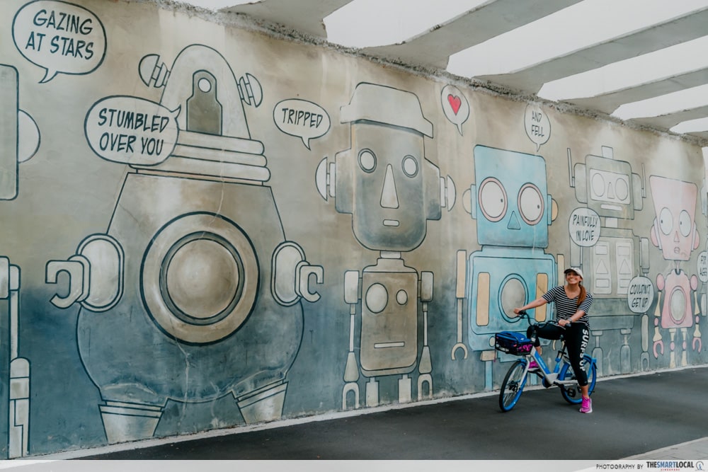
As you make your way towards Punggol, there are plenty of photo spots to look out for such as this mural.
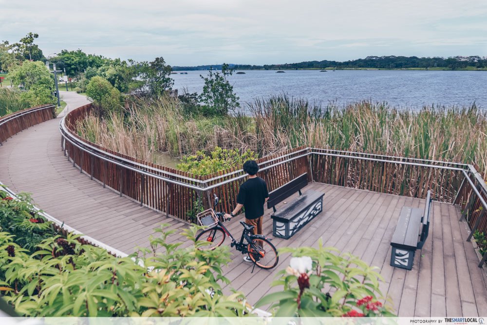
8. Punggol Waterway Park
The Jewel Bridge is one of the best spots to catch the sunset.
Punggol Waterway Park aka checkpoint 8 was probably our favourite part of the coast-to-coast trail. We crossed the iconic Jewel Bridge and many, many other pretty bridges.
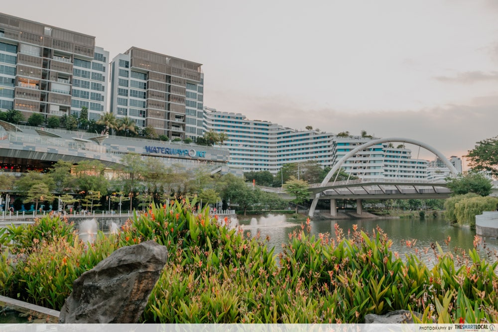
We finally got to Waterway Point and just had to get our BBT fix as well as take a toilet break.
After leaving the mall behind, make sure to cross over to the opposite side of the river using any of the upcoming bridges as you’ll have to turn left towards Coney Island Park Connector.
9. Coney Island
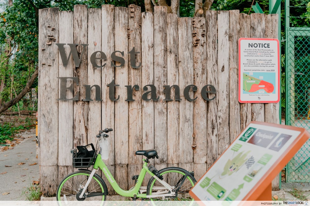
The path from Punggol Waterway Park to Coney Island is very straightforward and if you follow the map, you’ll be led right to the West Entrance. Do note that the only public toilet on the tiny island is on the opposite end at the East Entrance.
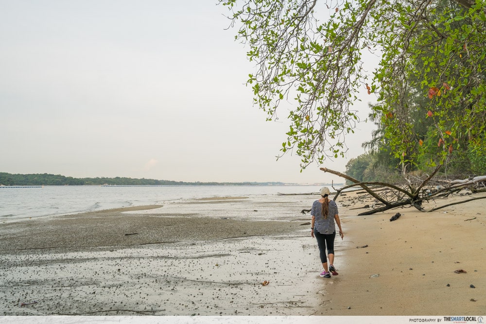
Beach Area A.
If you still have energy left, Coney Island is worth exploring if only for its empty beaches. We had the whole place to ourselves on a fine Tuesday evening around 6.30pm. There’s also an abandoned building said to be owned by the Haw Par family – yes, the same ones who owned Haw Par Villa.
And just in case you live in the East and want to head home, there’s a way to cycle from Coney Island to Pasir Ris. Otherwise, the other options are to take a bus from Punggol Road End bus stop, near The Punggol Settlement, or head back to Waterway Point for the MRT.
10. Rower’s Bay Park
Boardwalk along Rower’s Bay Park.
Although we completed our journey at Coney Island, there is the option of cycling another 35 minutes to Rower’s Bay Park. Located near Yishun Dam, this is the 10th checkpoint and is also known to be a lovely spot to catch the sun setting.
Plus, it’s close to Seletar Aerospace Park so you just might catch some planes landing or taking off. And if you’re hungry, there are a number of eateries in the area including Wheeler’s Estate and The Summerhouse.
How to prepare for the coast-to-coast trail?
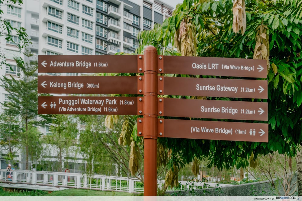
The coast-to-coast trail is rather long, so the first thing you want to do is download the Nparks Explore A Route app (App Store | Google Play). This will help you plan your route as well as serve as a guide to whether you’re on the right track. We followed the coast-to-coast trail on the in-app map and found it pretty straightforward.
Don’t worry, though, there are also coast-to-coast (C2C) sign boards along the way letting you know which direction the next checkpoint is and where the nearest toilets are.
Before you start your journey, make sure your phone has enough juice and bring along a power bank as a backup because the maps can drain the battery real fast. As with any outdoor activity, pack the essentials – a water bottle, sunscreen, hat or sunglasses, and a raincoat or umbrella in case of wet weather.
There are a number of water coolers along the way to refill your bottles but you won’t encounter them that frequently. Hence, keep your wallet with you to buy drinks and snacks whenever you need to refuel.
Whether you’re planning to walk or cycle along the trail, it’s also best to wear covered sports shoes. And if you want to be extra safe, bring your own helmet, especially if you plan to cycle on the road.
Explore Singapore via the coast-to-coast trail
Despite NParks’ official stats saying that the coast-to-coast trail is 36km, we found that by the time we ended, we had cycled almost 42km altogether.
As 2 amateur cyclists, it was probably for the best that we split the route into 2 days, making it very manageable. But we think it isn’t too difficult to do the entire trail in one sitting either. That should make all other beginner and casual cyclists confident of making the journey too.
More cycling guides:
- Eastern Corridor cycling guide
- Best long-distance cycling routes in Singapore
- Best neighbourhood cycling routes in Singapore
- Lesser-known cycling routes in Singapore
Photography by Shawn Loh & Pei Yee Lee.