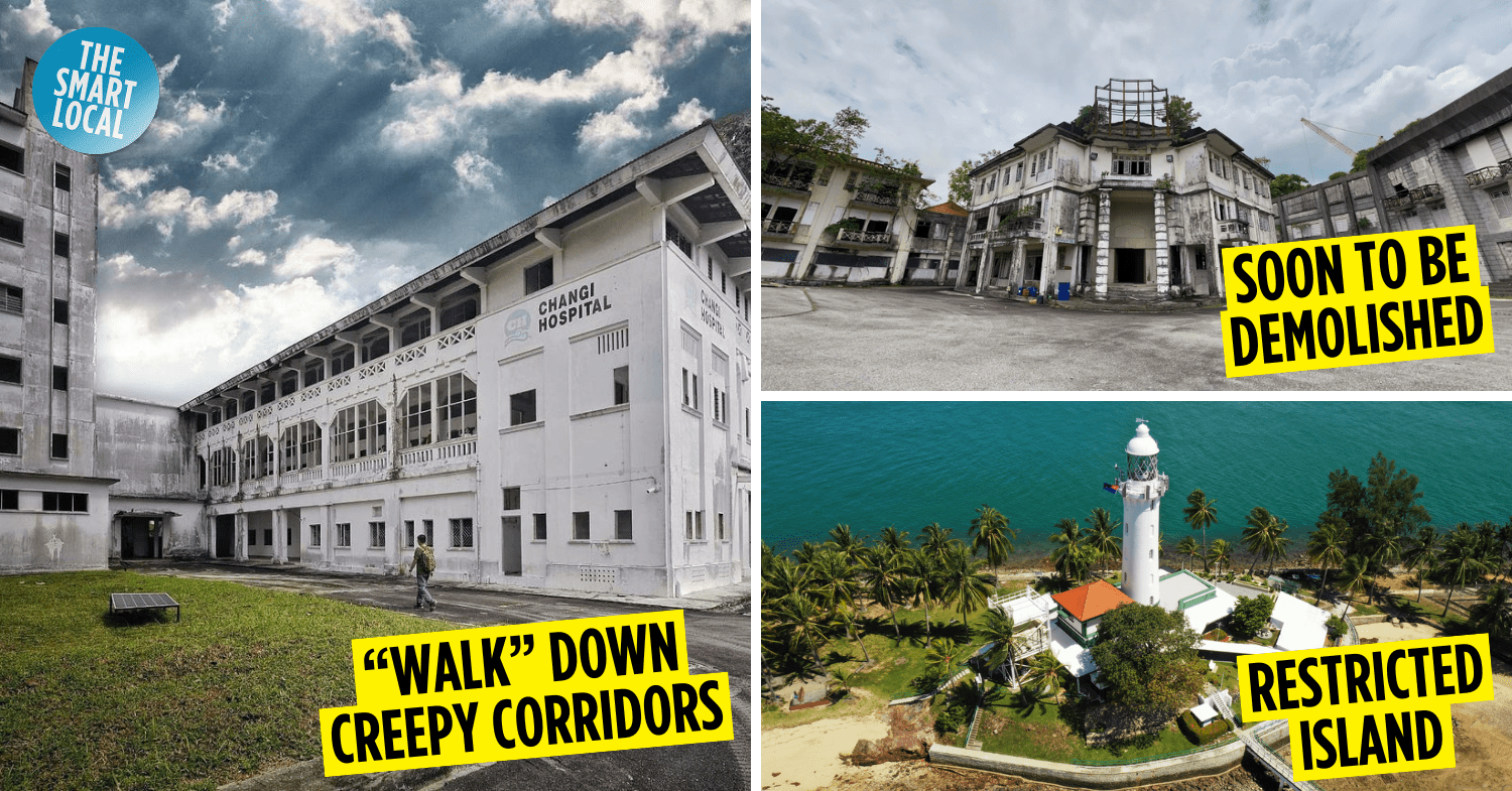
Restricted places in Singapore to explore on Google Maps
It’s no secret that Singapore, despite being spankingly First World, has its fair share of abandoned mansions and derelict haunts like Spooner Road estate and Keppel House. Places like these beckon to the adventurous, but those not gung ho enough to head down themselves can do so through the eyes of Google Maps to scratch that inquisitive itch.
If you’re game, here are some restricted places in Singapore that you can explore on Google Maps. You’ll even be able to roam the grounds of these locations using Google Maps’ roving Street View, which might be a double-edged sword if you’re equal parts curious and skittish.
Table of Contents
1. Old Changi Hospital
Haunted military hospital in the East
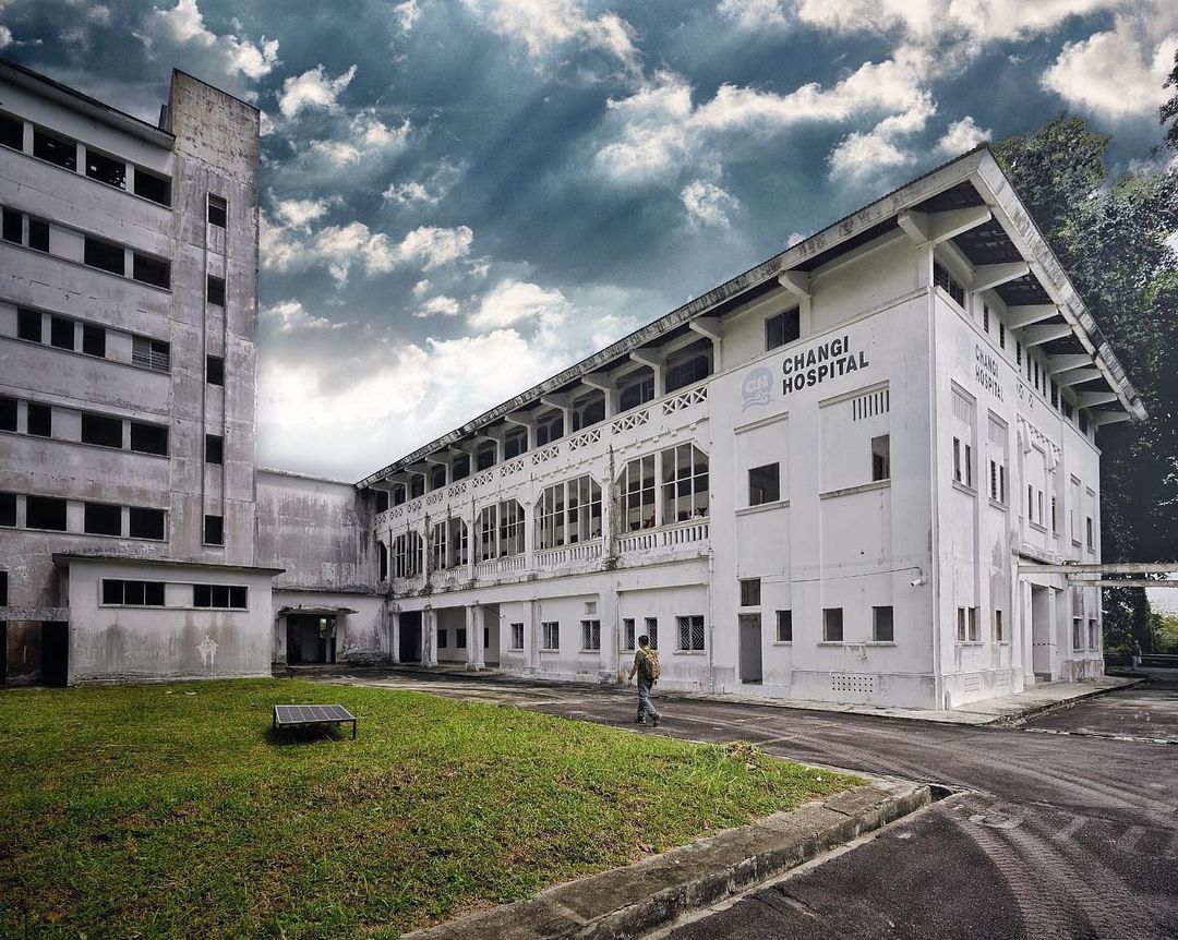
Image credit: @search.singapore via Instagram
Probably the most trespassed abandoned building in Singapore, you can’t possibly talk about a list of places that have gone to rack and ruin without mentioning Old Changi Hospital.
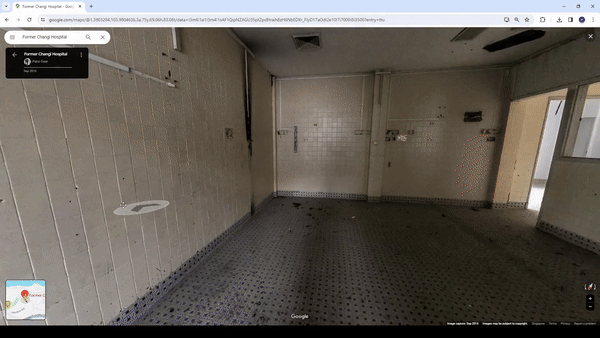
There are murmurs of an old torture device made out of thick chains hanging on the walls in one of the rooms.
Image credit: Pano Gear via Google Maps
The hospital was first built in 1935 by the British, but during the Japanese Occupation of Singapore during WW2, the hospital was converted into a jailhouse for prisoners of war. It was infamously run by the Kempeitai, or Japanese Secret Police, who were known for their liberal use of gruesome torture techniques.
This gave rise to rumours of the hospital being used as a torture centre. Just take a virtual look around and you’ll see why; the place practically looks like a still ripped from a horror movie, with its crumbling architecture and unkempt corridors. There’re also murmurs of blood-stained floors so keep a lookout for those if you dare.
2. Tuas TV World
“Old Singapore” set once used in Channel 8 dramas
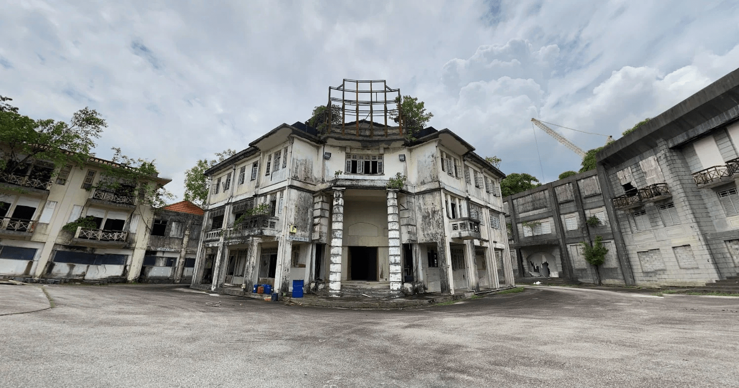 Image credit: Koon Hoong Muk via Google Maps
Although Tuas TV World does not share tales as scary as the ones that haunt Old Changi Hospital, it’s still quite unnerving to take a virtual stroll down its many asphalt roads.
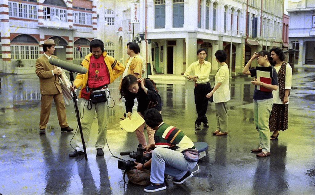
Image credit: Salleh Sariman via Flickr
The place was essentially the Singaporean equivalent of those grandiose film sets Hollywood used back in the days before CGI and green screens. You’ll find intricate replicas of local buildings from the 50s and 60s, used to shoot Channel 8 Chinese dramas of the 1990s to early 2000s.
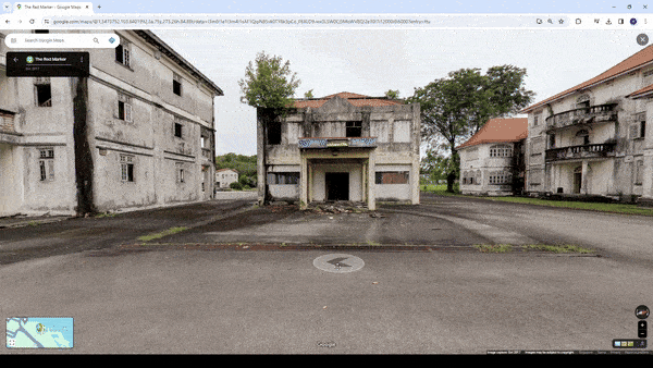
Image credit: The Red Marker
However, Tuas TV World is well poised to become a fragment of our memories, as its demolition is slated for Q2 2024. You can’t head down to physically take a trip down memory lane as entrance to Tuas TV World is prohibited; your next best bet is to remotely trawl through the archaic sets via Google Street View.
3. Attap Valley Bunker
82 year-old military bunker built by the British
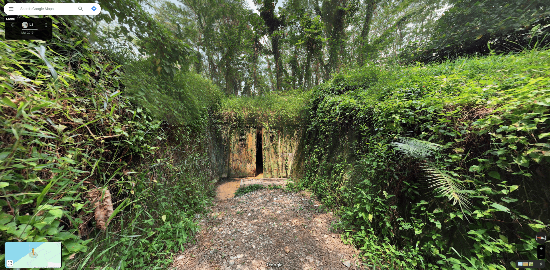 Image credit: L i via Google Maps
Another relic of Singapore’s bygone colonial era is Attap Valley Bunker, which was built way back in 1942 by the British. One of the only views of the bunker today exists on Google Maps, with this scene of its ominous double doors left ajar.
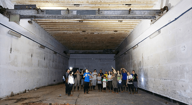
Image credit: Roots
There used to be tours back in 2015 which allowed the public to venture further through its doors. The bunker was previously a storage facility for the British Singapore Naval Base, and it was taken over by the Japanese when WW2 rolled around. After the war was over and done with, the bunker was left for nature to reclaim.
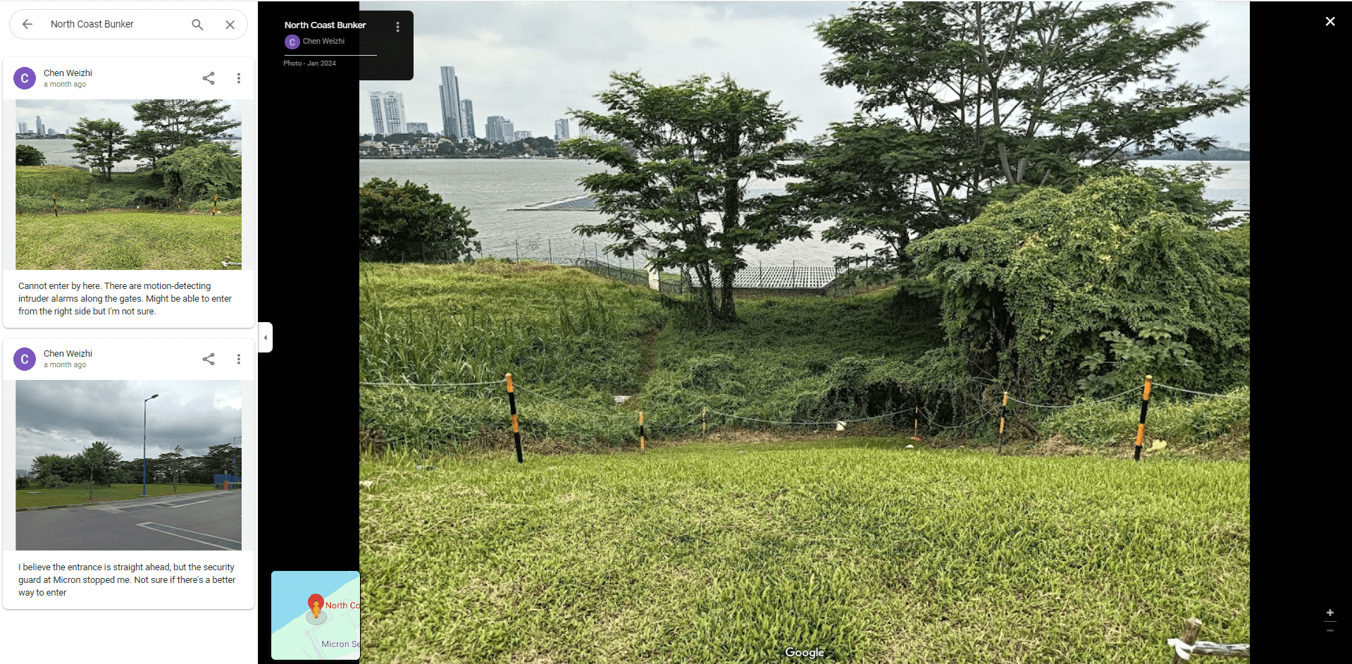 Apparently there are motion detecting alarms installed near the bunker to ward off potential trespassers.
Image adapted from: Chen Weizhi via Google Maps
The Attap Valley Bunker is strictly off limits to the public today, but this hasn’t deterred urban explorers one bit. We’ve stumbled across this lone Google Maps user who has been documenting his attempts to sneak a peek of the place. He hasn’t been successful so far, but we’d advise against even trying to sneak in, lest the cops are called in.
4. Istana Woodneuk
Abandoned mansion owned by the Sultan of Johor
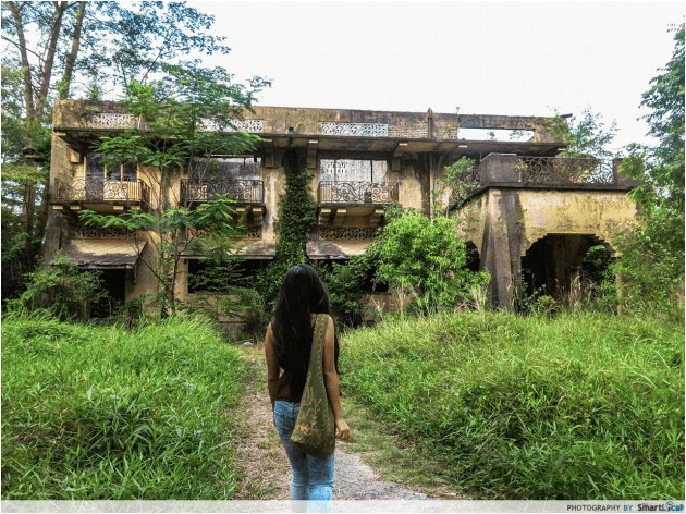
Those enthralled with Singapore’s supernatural goings-on will be no stranger to Istana Woodneuk. This 2-storey mansion was built in 1932 to house Sultan Ibrahim of Johor and his wife, but eventually fell to ruin after suffering through constant air raid bombings during WW2.
The house sustained further damage due to a fire in 2006 that was supposedly started by drug addicts. Today, the residence is overrun by vegetation, and you wouldn’t even be able to view its dilapidated remains in person. The police have officially closed shop for Istana Woodneuk, by cordoning off the path leading to the premises back in 2015.
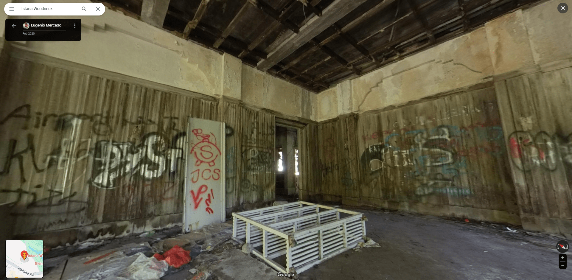 Image credit: Eugenio Mercado via Google Maps
You can, however, drop Google Maps’ Pegman – yes, the little guy has a name – to have a look within the Istana Woodneuk’s walls, but it ain’t pretty. Over the years, trespassers have left their marks on the palace in the form of graffiti and rubbish: it’s a far cry from what it would’ve looked like in its glory days.
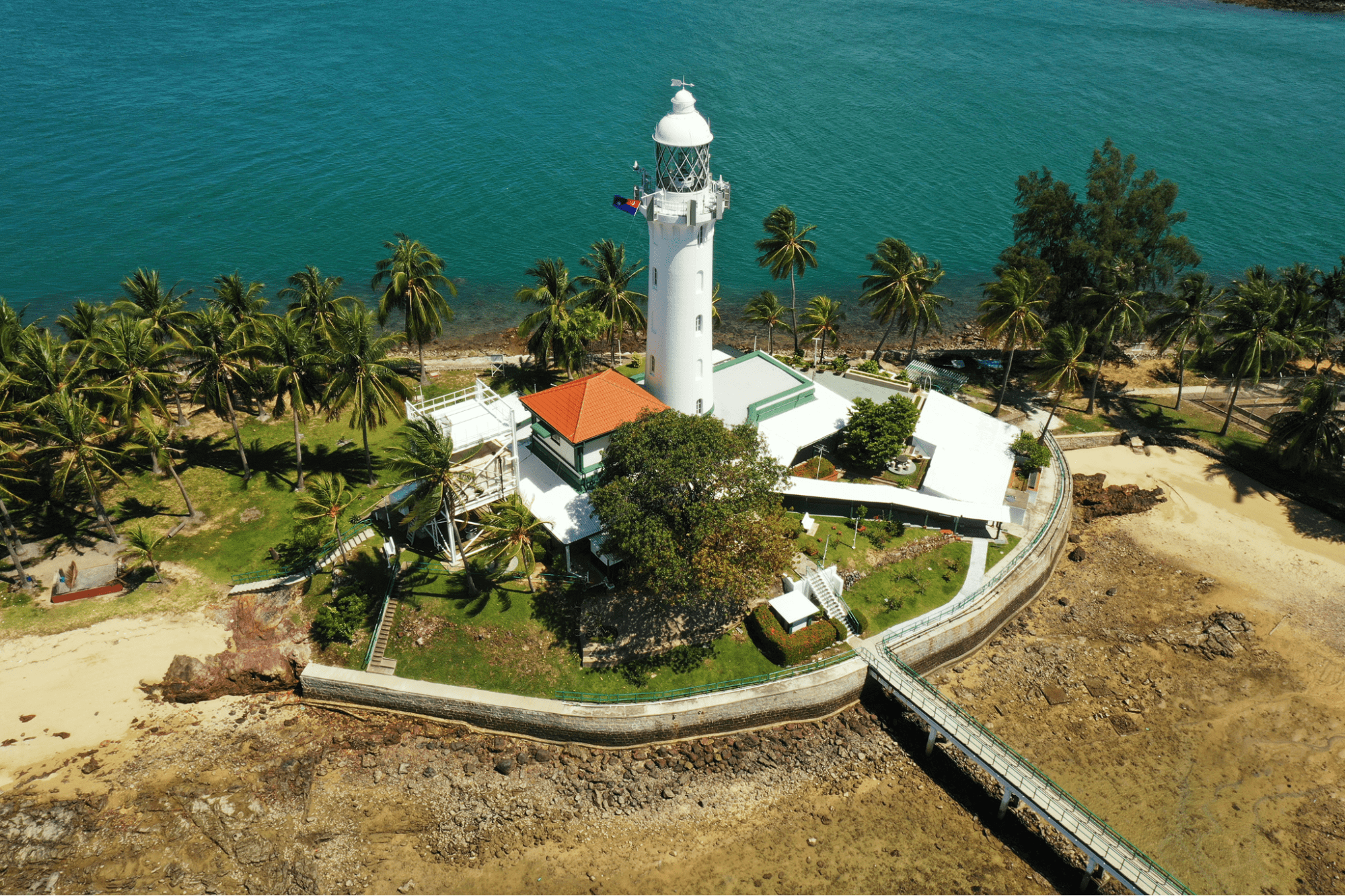
5. Raffles Lighthouse
Built in memory of Sir Stamford Raffles
 The lighthouse gets its name from Sir Stamford Raffles.
Image credit: Maritime and Port Authority of Singapore
The Raffles Lighthouse is the only location on this list that’s not abandoned in any way, but getting there is not as simple as you’d think. For one, it’s located on an offshore island on Pulau Satumu, which you can only gain access to via guided tours arranged by the Maritime Port Authority of Singapore.
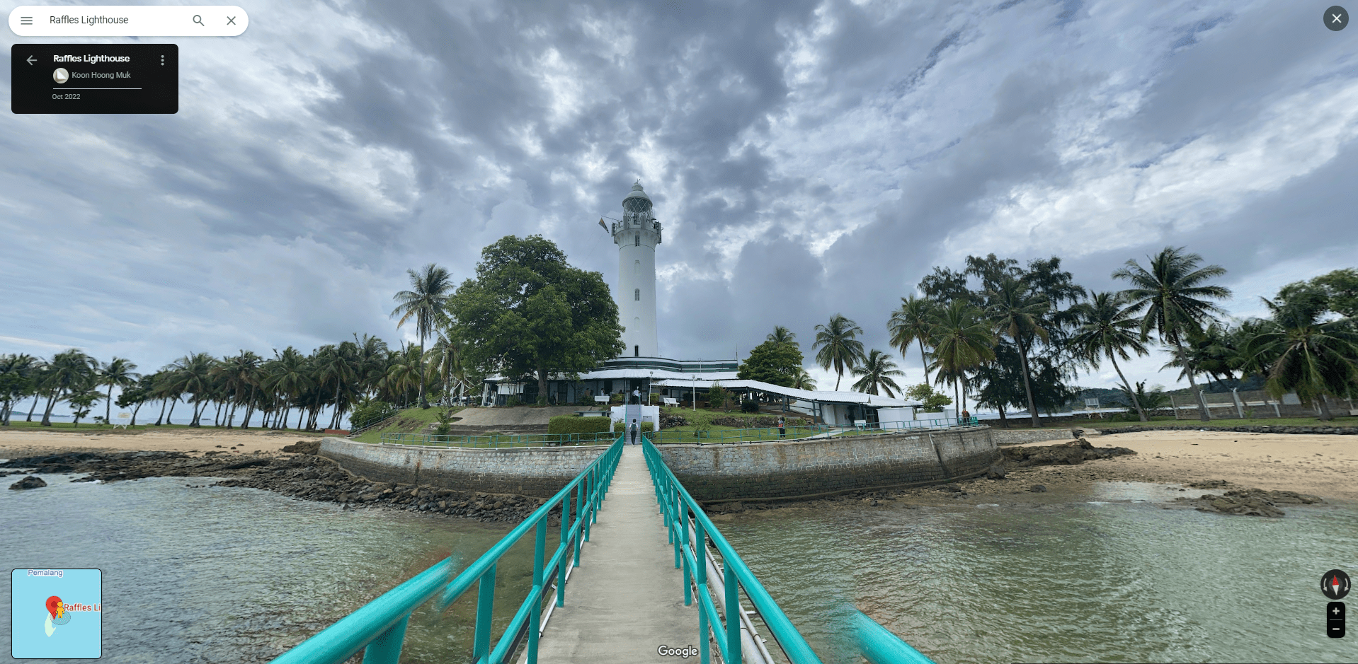 Fun fact: Pulau Satumu is the southernmost point of Singapore.
Image credit: Koon Hoong Muk
It’s not quite Tanjong Beach, but it’s definitely not as packed. The only thing to do on the island is to visit the lighthouse, and thankfully there are a few user-submitted 360° photos on Google Maps that allow us to view this solar-powered beacon of light.
6. Syonan Jinja
Remnants of a destroyed Japanese shrine from WW2
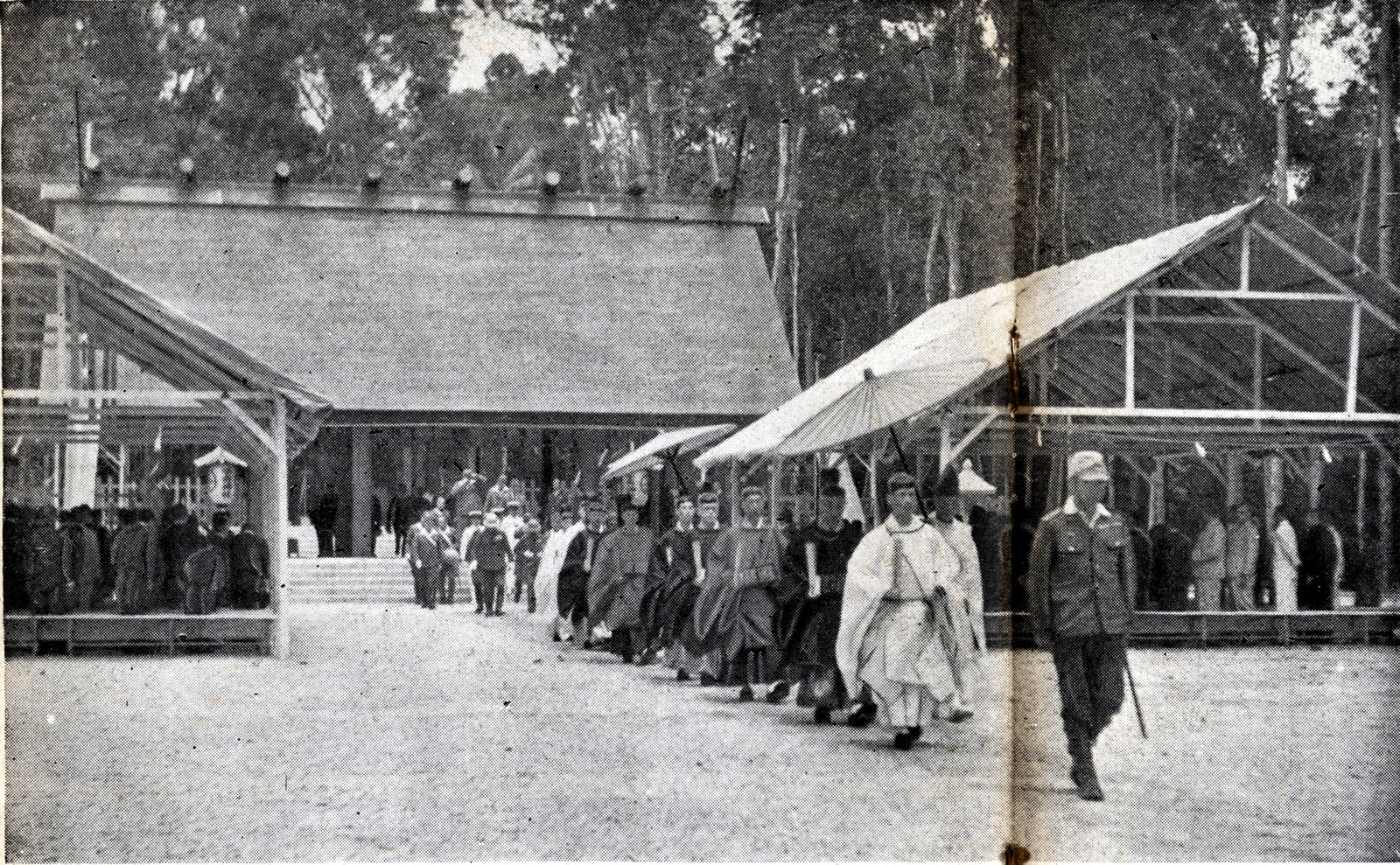 Image credit: Himoji
If you’re hoping to see Singapore’s only Shinto shrine, well, you’re all out of luck. Only the remnants of Syonan Jinja, yet another relic of WW2, lie dormant in the thickets of MacRitchie Reservoir. The shrine was built by the Japanese in 1942, just 2 months after the fall of Singapore, complete with a bridge leading visitors to its entrance from the main road.
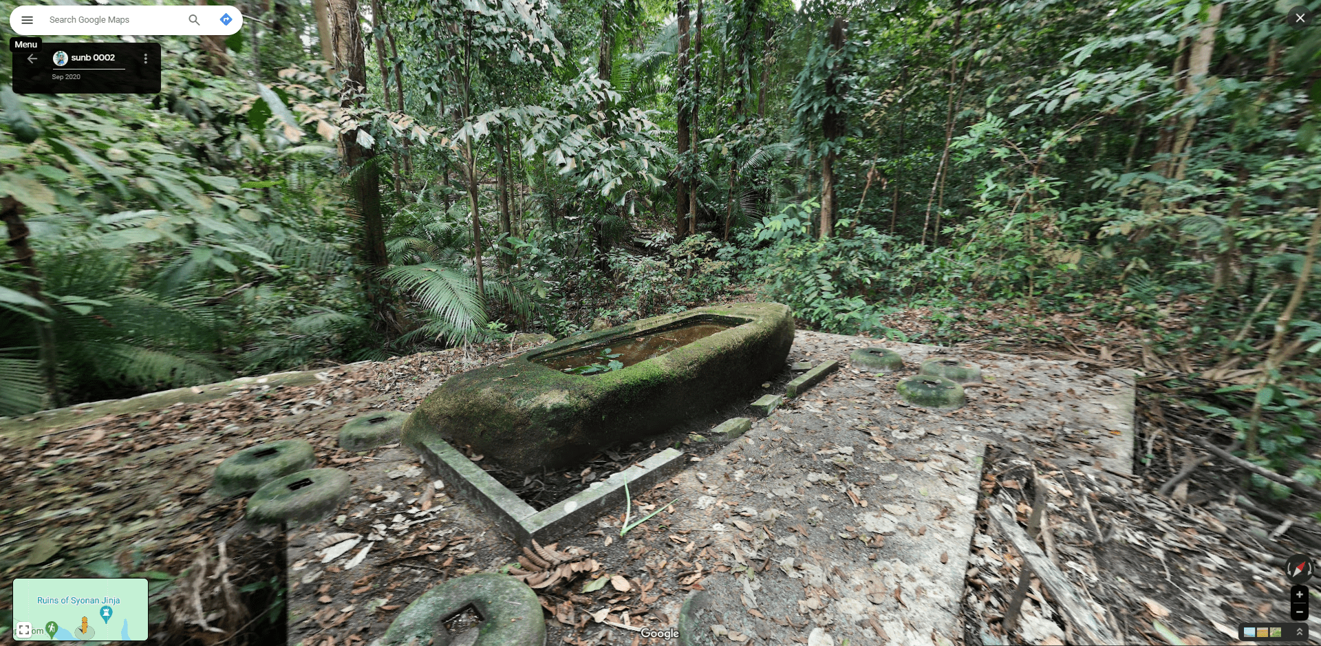 Image credit: sunb 0002 via Google Maps
However, it was the Japanese themselves who tore it down before their impending defeat as they did not want to risk the Allied forces defiling their sacred shrine. It’s illegal to visit the grounds of the shrine today without official permission, as it’s listed by the National Heritage Board as a historic site.
It’s not that there’s much to see anyway, as the only picture on Google Maps of what remains shows. All that’s left of the shrine is a solitary pavilion with a water basin which was used for ceremonial rites. Eerie indeed.
7. The Istana
President of Singapore’s office, only open 5 times a year
The Istana, AKA the President of Singapore’s office, where state guests are received and entertained, is closed off to the public for most of the year. However, there are 5 days a year when the public is given access to roam its exclusive grounds during the Istana Open House. These open house days fall on annual public holidays such as Chinese New Year, Labour Day and more.
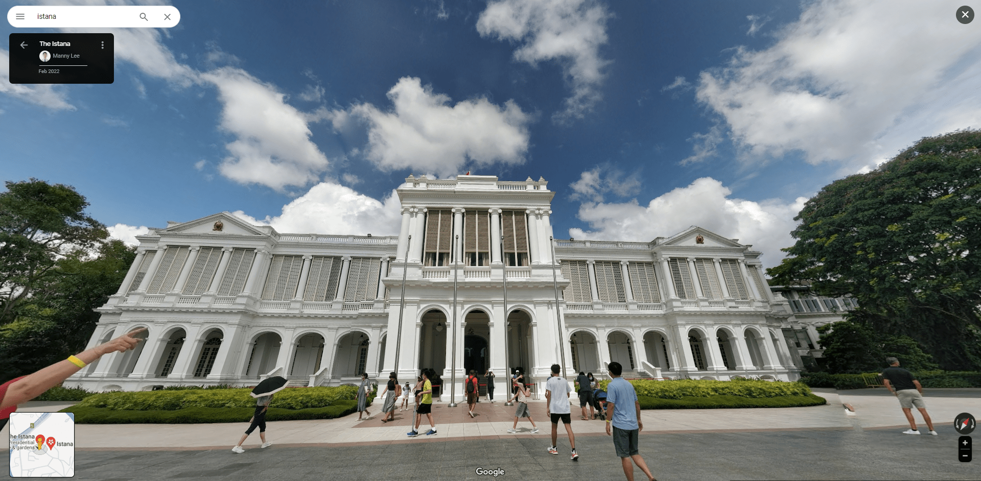 Image credit: Manny Lee via Google Maps
If you can’t wait for the next time the Istana’s gates are open to all, you can hop on Google Maps to have a self-guided, remote tour of its premises. There are various spots you can drop Pegman off to view the Istana through its eyes, and have a gander on the expansive lawn and gardens of the Istana, as well as the various fountains and ponds of the palatial abode.
Bonus: Bukit Brown Cemetery
Tombstones reclaimed by nature
Bukit Brown Cemetery might just be a stop along the way for those in search of the IG-worthy Avatar trees, but this old graveyard houses quite a few notable sights as well. For the morbidly curious, they can make the trip down in-person to traverse the graveyard as it’s open to the public, while the meek can visit via Google Maps instead.
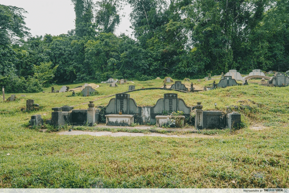
Image credit: ODOCO Agency Singapore via Google Maps
For starters, there isn’t a clear designated path for you to follow, so you’ll have to haphazardly navigate through various tombstones. There’re a total of 25 graves strewn about the forest floor; at least on Google Maps, you won’t have to worry about desecrating them with a misplaced step.
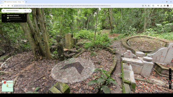
Image credit: ODOCO Agency Singapore via Google Maps
Once you’ve ventured far enough into the cemetery, you’ll stumble across a few graves that are more extravagant than others. One that you can’t miss is this one dubbed the Ong Family Complex. You’ll be able to get up close to observe its lavish details, which include statues of Sikh guards, lions, and even has a moat.
Boot up Google Maps to explore these restricted places in Singapore
Keep in mind, most of the locations on this list are restricted areas that even the globe-trotting wheels of the Google Street View car cannot venture into. The pictures you see here were taken by foolhardy explorers who have risked getting into trouble with the law, or shot years ago before these places were closed off to the public.
Regardless, you’d do well to steer clear of these locations, and appreciate their forlorn beauty frozen in time on Google Maps.
For more on Singapore’s historic buildings:
- Fort Serapong in Sentosa
- Malay Film Production Studio
- Paya Lebar Airport AKA Singapore International Airport
Cover image adapted from: @search.singapore via Instagram, Koon Hoong Muk via Google Maps, Maritime and Port Authority of Singapore
Originally published on 27th February 2024. Last updated 21st April 2025.