Malaysia’s hiking trails for the adventurous
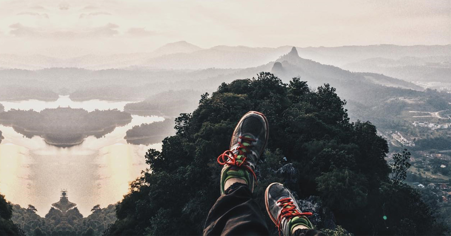
Source: @njma_shim
There are two kinds of people – those who stare blankly at the television screen all day, and those who aspire to reach Mount Everest’s summit. For the latter, Malaysia offers these larger-than-life mountaineers a stepping stone – a training ground – before scaling the actual mountain.
Our hilly landscape has got pieces of everything – exciting landscape, rich history and enchanting flora and fauna – for an enjoyable, eye-opening hike. With difficulty levels ranging from beginners to experienced hikers, here are some stunning hiking trails in two areas of Malaysia, Perak and Selangor, which you’ll enjoy.
Perak
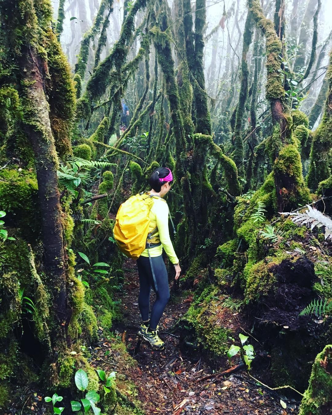
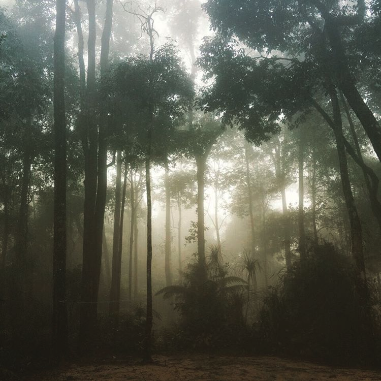
1. Gunung Liang (East and West) – Intense jungle hike
Source: @mfa06
Location: Behrang, Perak
Height: 6343 feet (1933 metres) above sea level.
Distance: 9.4km or 5.84 miles
Source: @siewmei_1218
Gunung Liang is a combination of leeches, rivers and dense jungle – which sounds like the perfect idea of a vacation for the outdoor enthusiast. It’s easy to get lost in Gunung Liang’s thick vegetation and the slippery ground ensures your hiking boots are tested. The hike is known to be extremely difficult and it’ll test the limits of physical and mental strength!
How to get there: The hike starts at Kampung Sungai Dara. You are advised to report to Nehrang station’s police station to let them know of your hike! Click here for details on getting there.
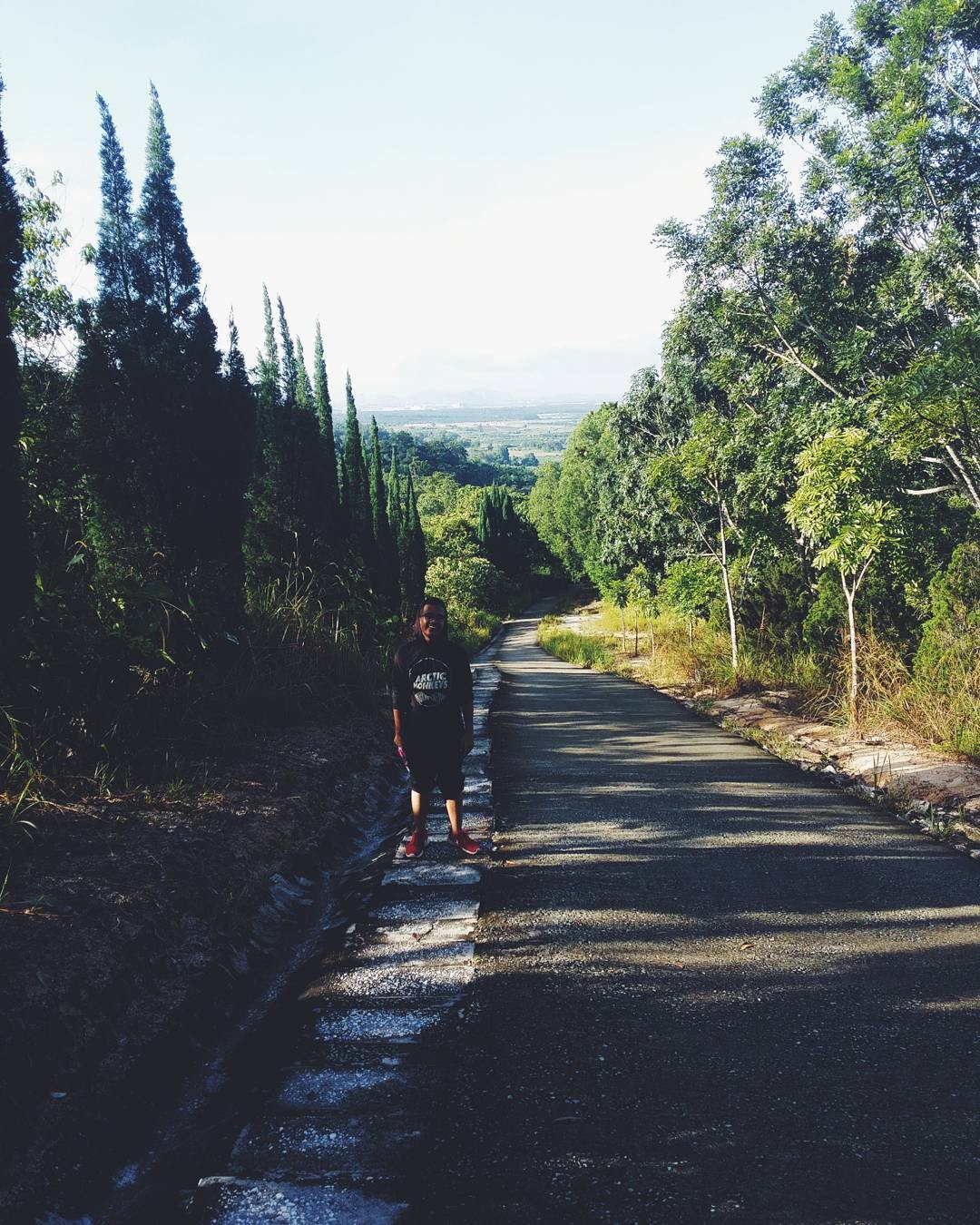
2. Bukit Kledang – 4 hiking routes to choose from
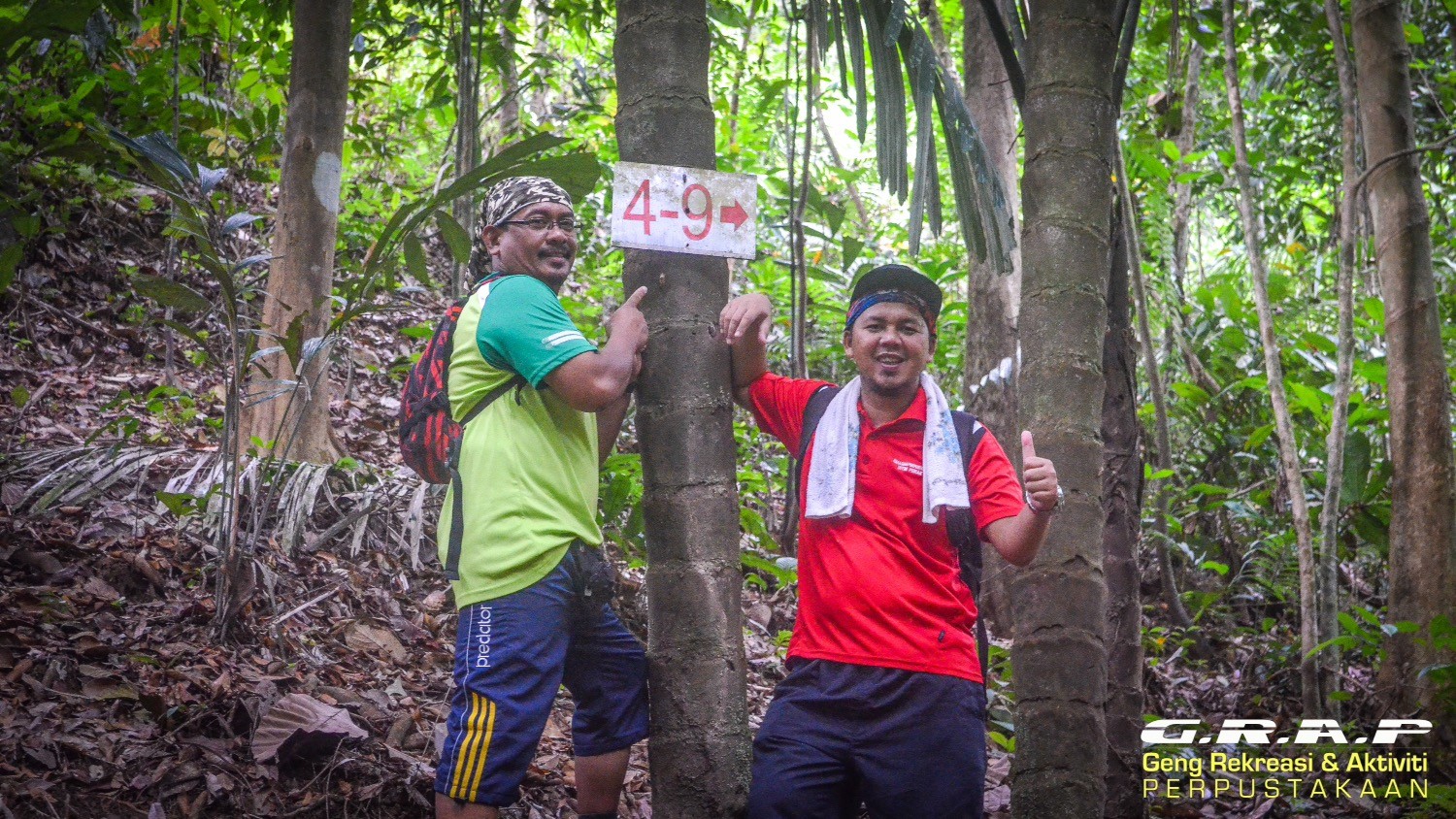
Here’s a hike with five trail options – Main Road, 4-2, 4-3, 4-9 and RTM. Each of the routes have different levels of difficulty, with 4-2 being the easiest, offering only a short one-hour trek. Alternatively, exhaust yourself to a four-hour RTM trek which ends all the way up on the summit, where the broadcasting tower resides.
Source: @ashshikin
How to get there: There are two ways to enter the trek depending on which route you choose. Main Road’s trail starts here while the other four routes start here. Open them in Google Maps and drive to those destinations by mapping out where you are coming from!
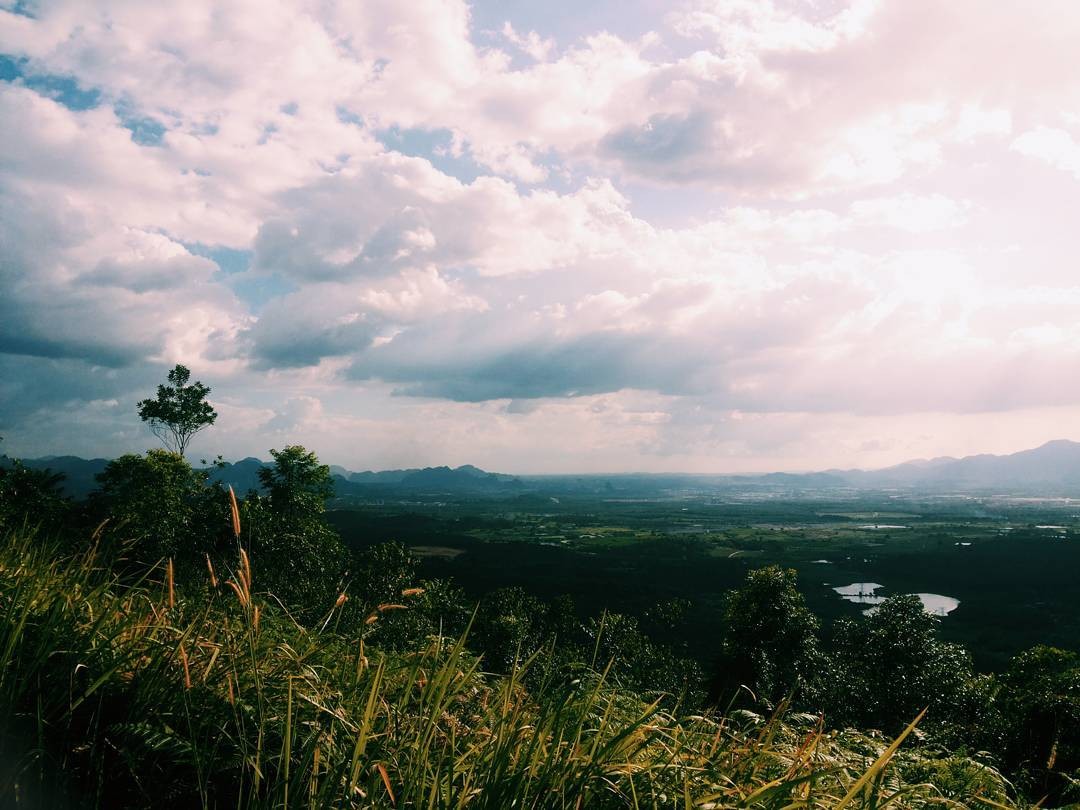
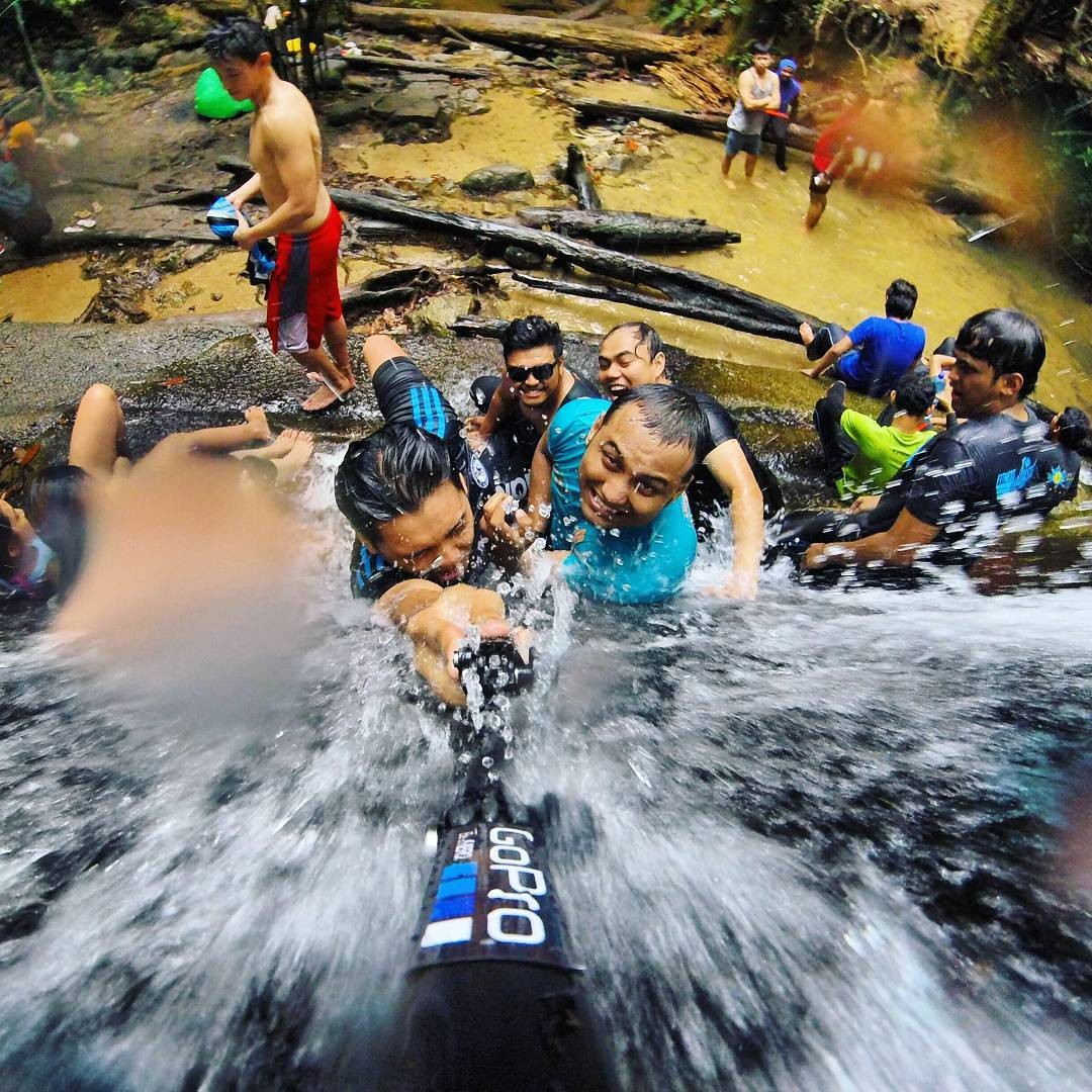
3. Lata Kinjang Waterfalls (Tapah) – Dip in the natural waterfall pool
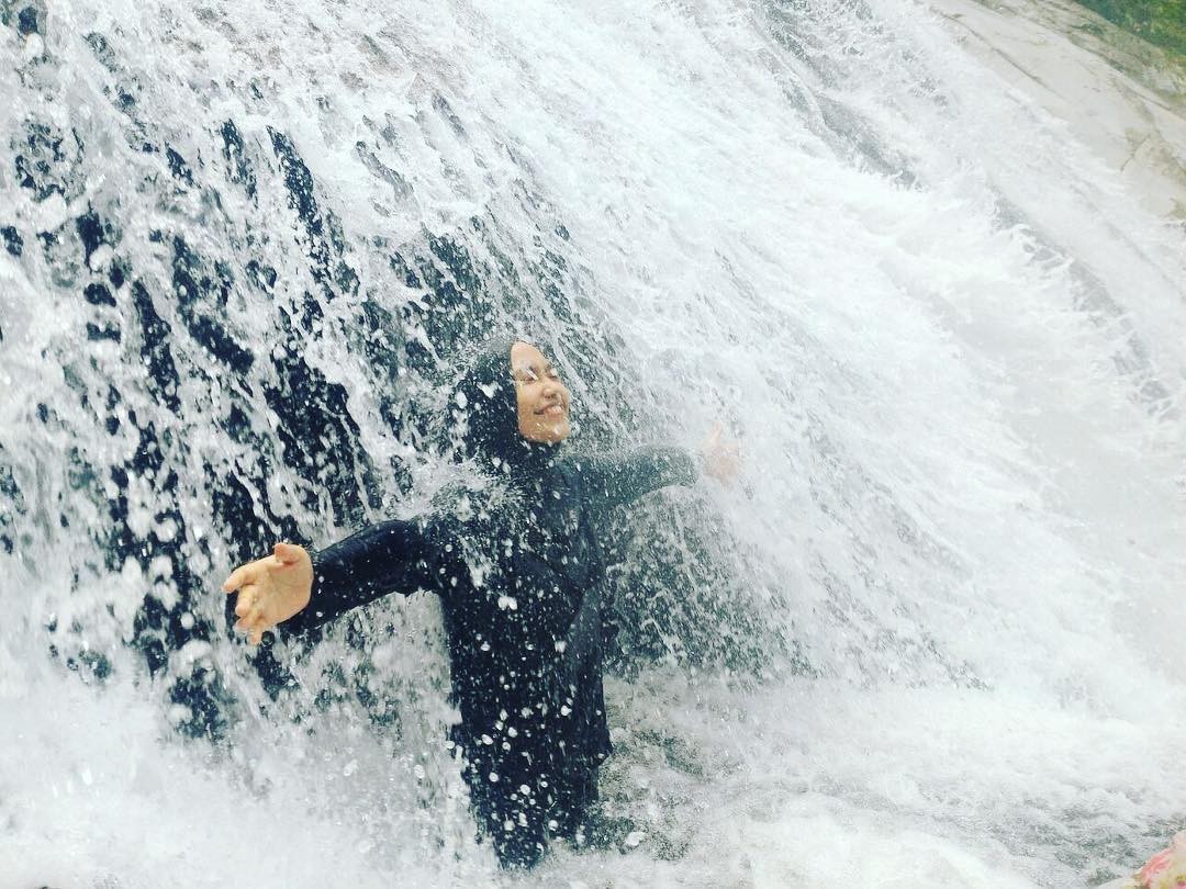
Source: @izzaihan
Location: Near Chenderlang (18km from Tapah)
Trek distance: 200m, on rocky slopes and hills.
One of the tallest falls in Malaysia, Lata Kinjang, is located near (and even visible from) the North-South Expressway. The hike is upstream, so the route is clearly laid out. Your only concern is the water that cascades down the rocks, making the ground a slippery slide of doom. To be safe, stick to the sides where it’s dryer.
The hike gets steeper past a bridge in the middle and you’ll no longer be able to climb upstream so find a way within the forests to get to top of the waterfall. At the summit, you’ll be able to observe a stunning view of the waterfall, as well as the North-South Highway, a rewarding sight after a tedious hike. Alternatively, don’t hike at all – spend the whole day dipping in the waterfall’s massive, cooling pool.
Source: @umyunique
Address: 35300 Chenderiang, Perak, Malaysia
How to get there: Click here to view its location in Google Maps. You will need to drive out to Chenderiang mukim (district) from town first.
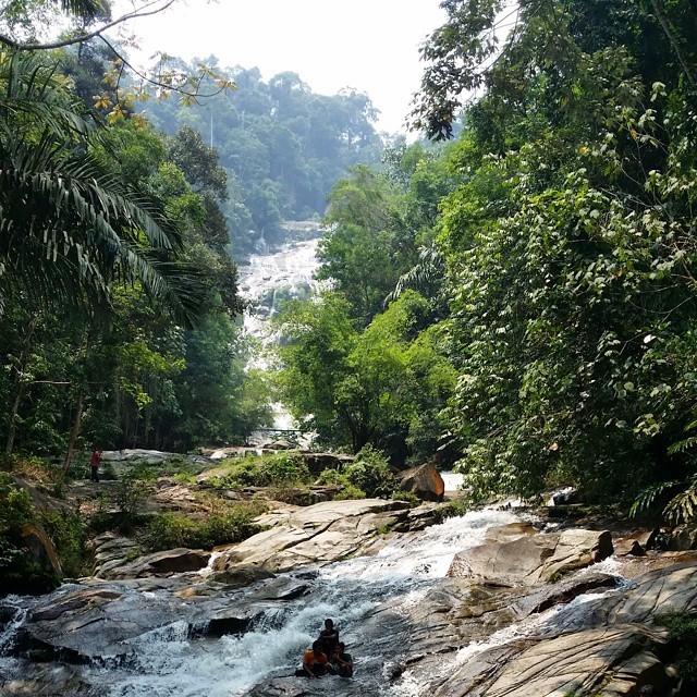
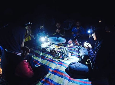
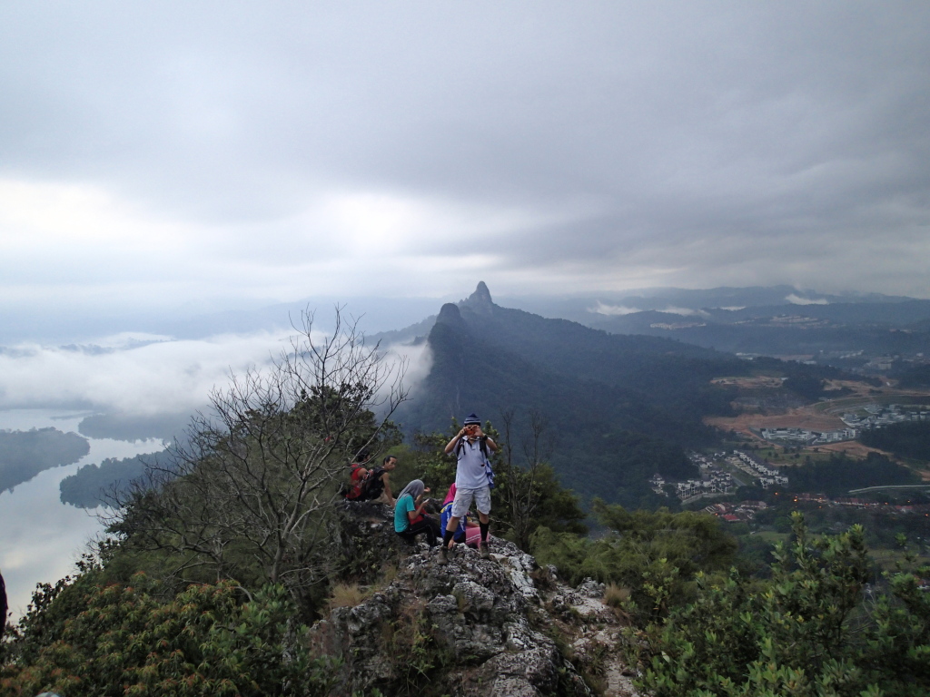
4. Gunung Bujang Melaka (Kampar) – Have a night camp-out
Source: @kitahiking
Location: Kampar, Perak
Hike duration: 4 – 5 hours or a 2 day 1 night stay.
Distance: 6.2km from base to peak.
Located near the Lata Kinjang Waterfall, day hikes in Gunung Bujang Melaka are enjoyable and easy. However, a more relaxed camp-out at night is fitting for a cool, misty forest hidden within the hill. When dusk falls, you’ll be creeped out at first, but once the forest settles into the night, you and your buddies will grow to love the feeling of being out in the dark.
Don’t start hiking from the early morning if you’re camping because the hike doesn’t last for days – just hours. Start hiking in the late afternoon to find a good spot to set up base camp.
Source: @irwan_fendi
Address: Gunung Bujang Melaka, 35300, Perak, Malaysia
How to get there: Click here to view its location in Google Maps.
5. Bukit Bangkong (Chemor) – Best for beginner hikes
Source: @adlanrashdan
Location: Tanah Hitam, Chemor
Height: 311 metres uphill.
Bukit Bangkong is one of the most popular hiking spots in Chemor, its route a concrete road so those who are used to the softer forest terrain may get slightly uncomfortable. Nevertheless, it’s great for beginners who prefer a clear concrete path over mud, roots, leaves and trees that confuses the journey. As the top rests 200-300m above sea level, prepared to be amazed by the stunning view of Chemor.
Source: @no_rule95
Address: Tanah Hitam, 31200 Chemor, Perak, Malaysia
How to get there: Click here to view its location in Google Maps. You will need to drive out to Tanah Hitam first.
Selangor
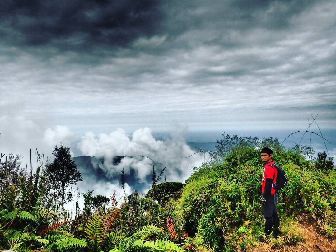
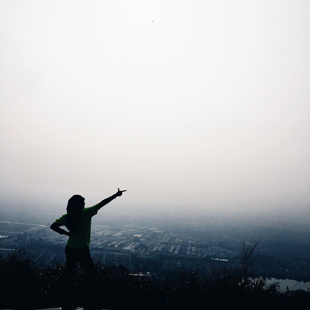
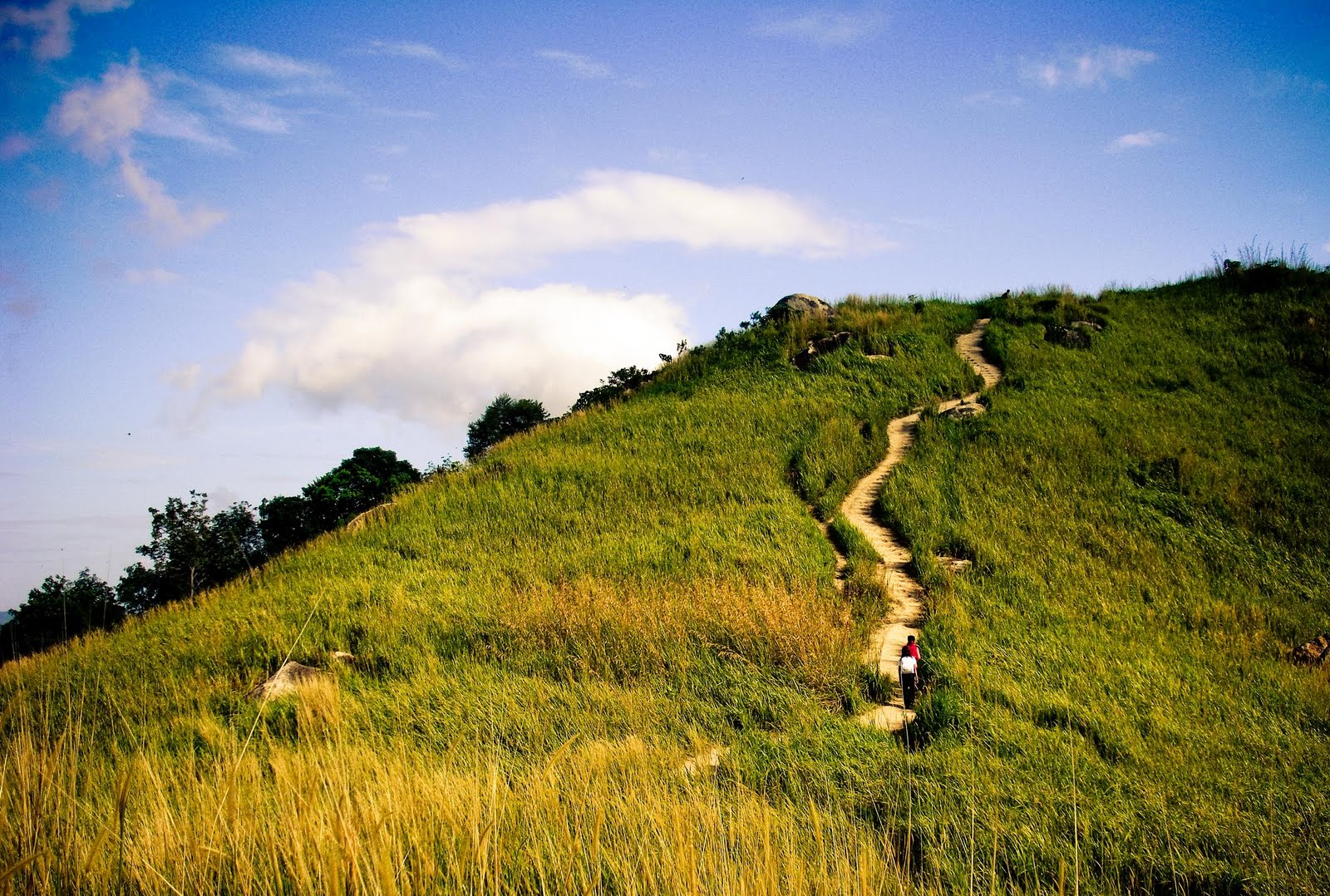
6. Bukit Tabur (East And West) – For those training to hike Mount Everest
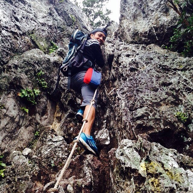
Source: @hafiz_norazeman
Location: Taman Melawati
Height: 396m
Distance: About 3km
Bukit Tabur is frequently attempted by ambitious and experienced hikers. Do not take this trail lightly – the trek has steep rocky terrains and requires a bout of rock-climbing. It is highly recommended that you go in groups, preferably, with technically-experienced hikers with plenty of hiking know-hows since there are no railings to guide and prevent falls.
Logically, night hiking here is a no-no. You don’t want to bear such a risk. With that, you’ll require a permit (RM5) at the Pejabat Hutan Daerah Selangor Tengah before being able to secure the hike.
Pejabat Hutan Daerah Selangor Tengah
Address: Km 11, Jalan Cheras, Cheras, Selangor, Taman Cuepacs, 43200 Kajang, Selangor, Malaysia
Bukit Tabur
How to get there: There two ways in for Bukit Tabur. For the west trail, click here. For the east trail, click here.
Bonus: There’s also a third trail, “Bukit Tabur Extreme”. Click here for a detailed version of getting there.
Source: @njma_shim
How to get there: Click here to view its location in Google Maps.
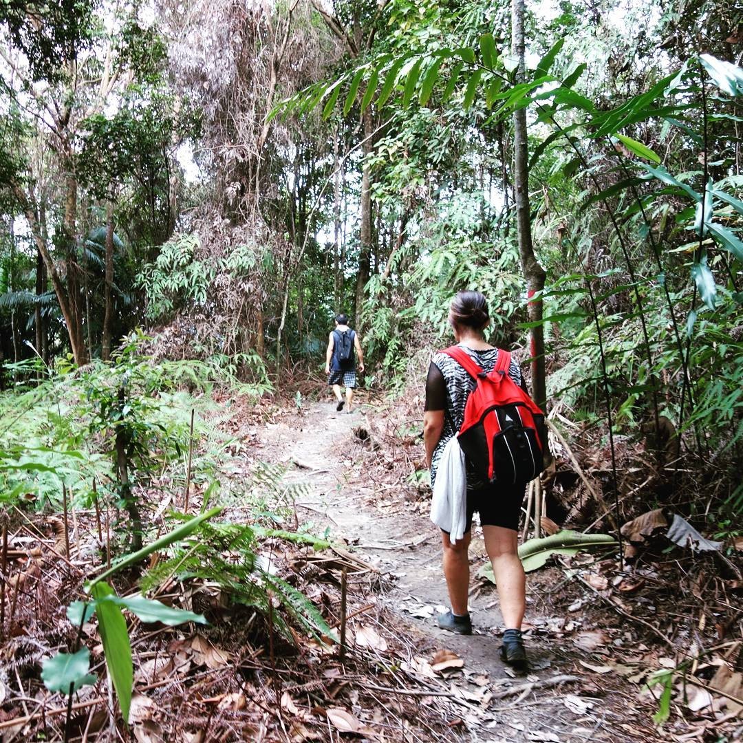
7. Bukit Saga
Source: @syidakamar
Source: @hikersforlife
Unlike Bukit Tabur’s intense route for experienced hikers, Bukit Saga is the perfect starting point for aspiring mountaineers, with its short two to three hours hike. It’s an easy trail with stations specifically set up for a journey through the hill. But be wary – with the network of trails available in the forest, the probability of getting lost is high.
At the peak of Bukit Saga, take a peek (excuse the pun) of the Kuala Lumpur Tower and the city landscape from the shrubs. Once you’ve had enough sun for the day, cool off at the calm waterfall, one that’s not as violent and massive as the Lata Kinjang Waterfalls.
Source: @azrieanuar
How to get there: The entrance of the trail starts here. The map of the whole trail can be found in Google Maps!
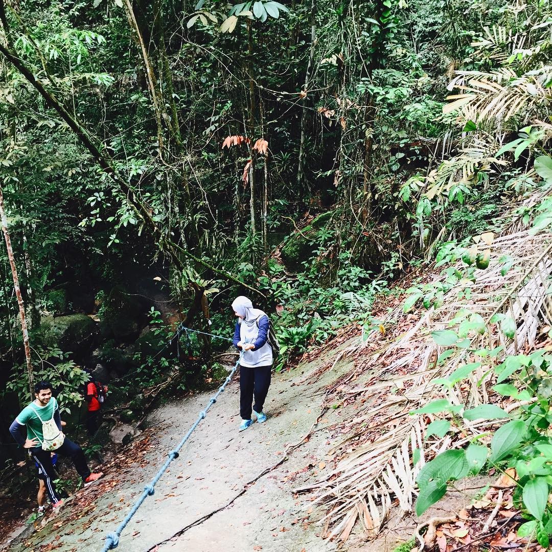
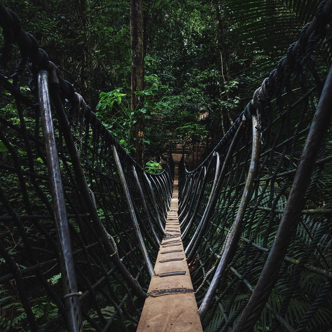
8. Bukit Gasing – Jungle trek through the suspension bridge
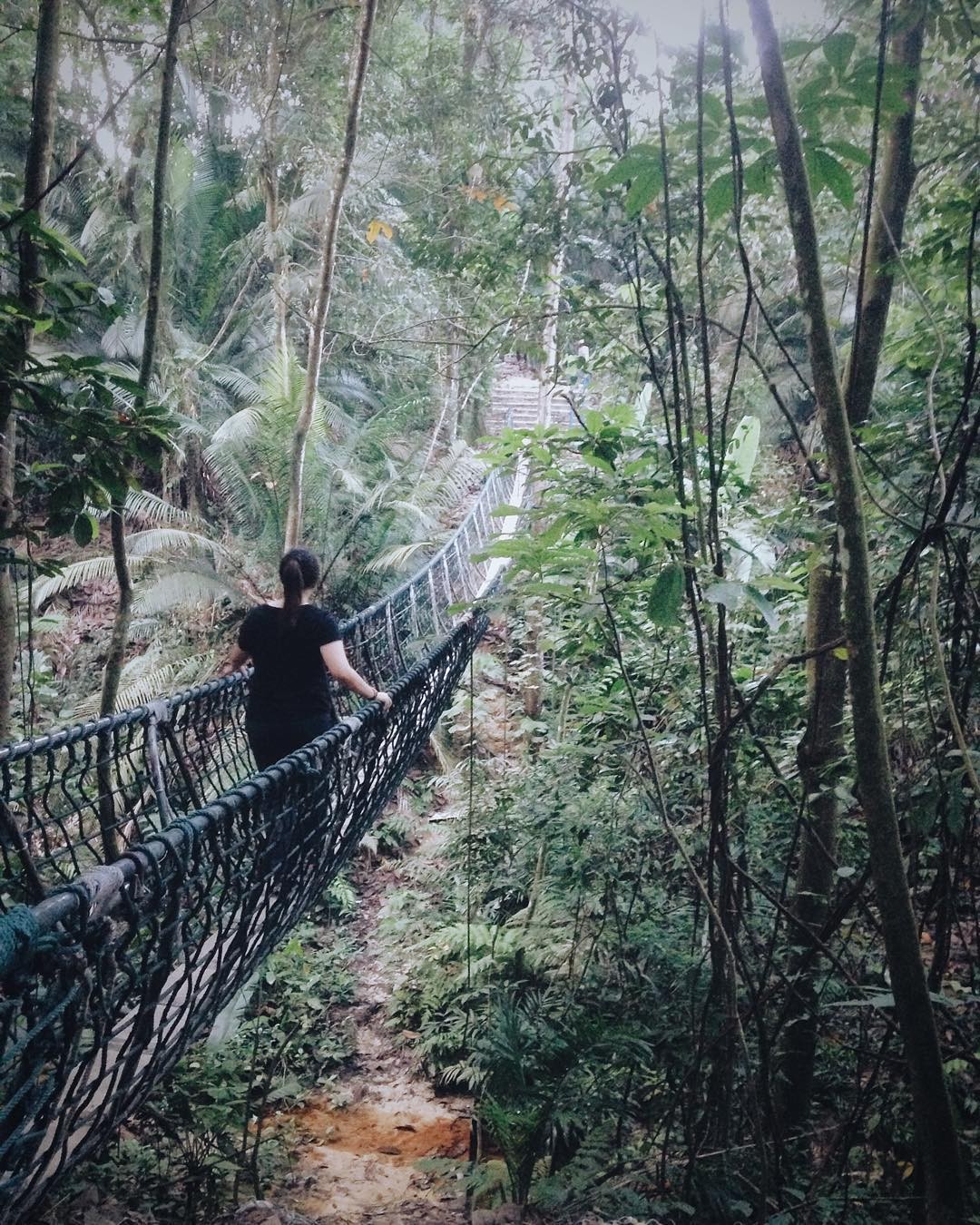
Source: @munsya
Location: Bukit Gasing Forest Park
Height: 160m
Duration: 1 – 2 hours of hiking
Fifteen minutes from the Federal Highway lies the very popular Bukit Gasing, offering a multitude of trail routes. Would-be hikers have a choice between a steep flight of stairs or conquering a suspension bridge in the middle of it all. Unlike most jungle bridges, this one has a walking space of a single person so acrophobics (fear of heights) may experience trouble walking through.
While not ideal for those with a fear of heights, the bridge offers a sense of accomplishment to those who try anyway. It’ll help build some confidence to finally kick the phobia. In any case, you won’t lose your way when the panic sets in – lots of locals hike there, so if you ever get lost, rest assured there will be someone to help.
Source: @abuhnfhhh
Address: Bukit Gasing, 46000 Petaling Jaya, Selangor, Malaysia
How to get there: Click here to view its location in Google Maps.
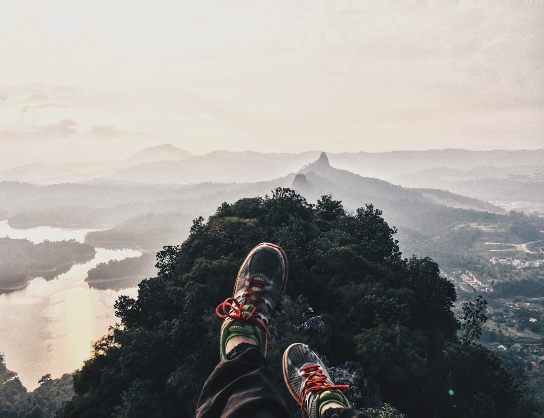
9. Bukit Broga – Snap a photo of the sunrise at the top
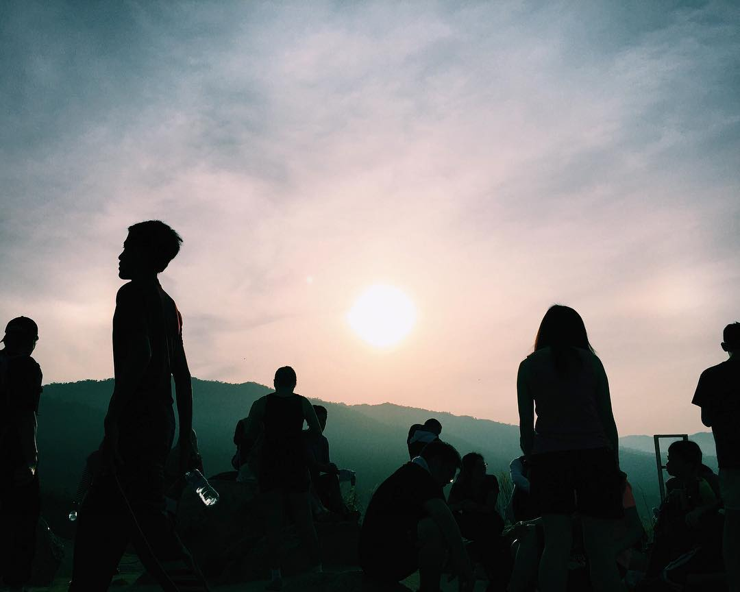
Source: @clicksbyquwais
Located in Semenyih, a short drive from Kuala Lumpur, Bukit Broga offers an opportunity for you to tick one item off your bucket list – having a photo taken in front of a sunrise. Bukit Broga has a low gradient incline and is thus, a pretty manageable climb.
If you’re planning to embark on the 400-metre hike for the sunrise, experienced hikers recommend beginning your ascent at or before 5 am. If the stars are aligned, then you’ll find yourself at the top amongst clear skies and golden rays – you amongst 30 others. So pick a spot that’s quiet and spacious enough for a solo picture with the sun! But be careful on your way down – it’s slippery.
Address: Jln Broga, 43500 Semenyih, Selangor, Malaysia
How to get there: Click here to view its location in Google Maps.
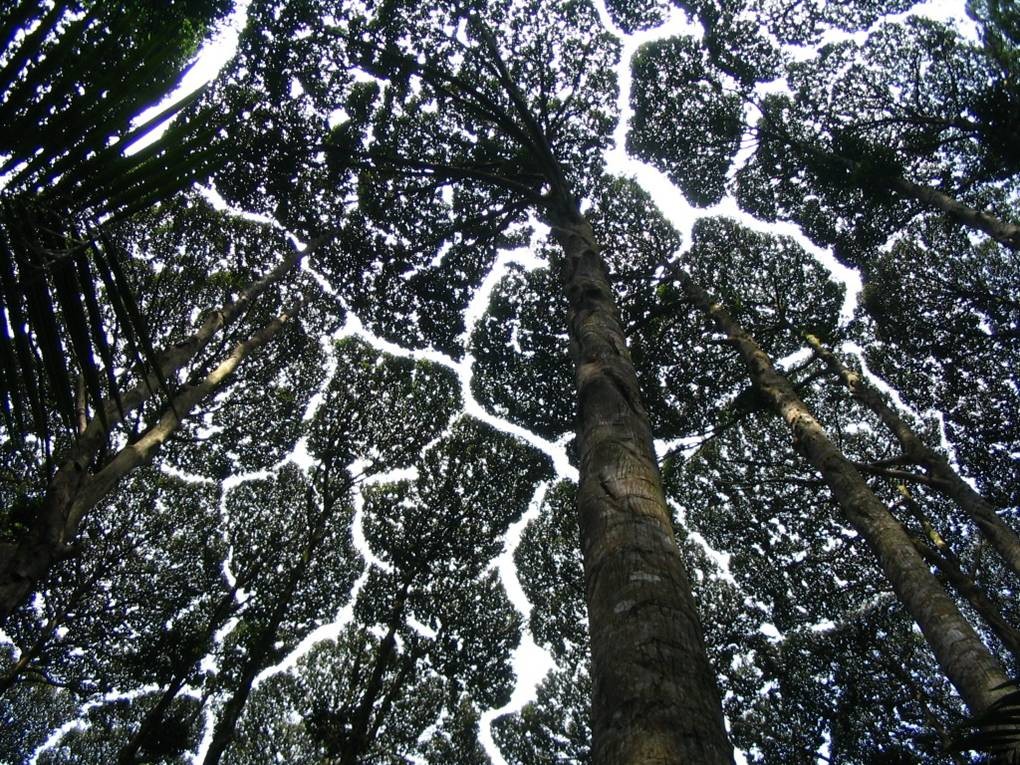
10. Forest Research Institute Malaysia (FRIM) – The canopy trees’ leaves tessellate!
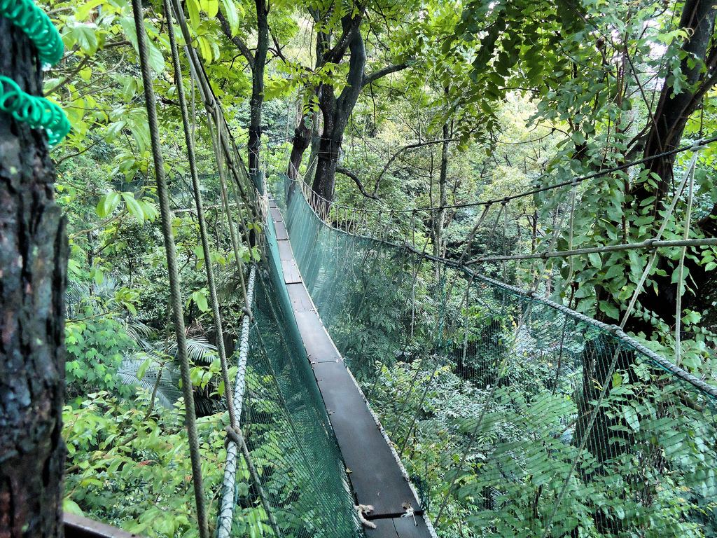
For RM20, FRIM is a hike at a steal for those looking for a place to start off at. Surrounded by forests (it is, after all, a research institute), you can choose to bike, hike, walk or jog your way through this trail. Like many fun trekking experiences, there’s a canopy walk for those who love scaring others by rocking the bridge.
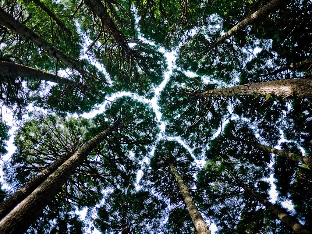
One of the main features of the forest research is the ‘Crown Shyness’ phenomenon, where the leaves and branches of canopy trees do not touch each other, creating a pretty tessellation. This is one forest that’s naturally insta-worthy! The trail takes one to two hours stroll to complete – great for a day out with your SO.
Address: Jalan Frim, Kepong, 52109 Kuala Lumpur, Selangor, Malaysia
How to get there: Click here to view its location in Google Maps.
Best trekking routes in Perak and Selangor
Source: @capiqzahari
From trekking up waterfalls and dense forests to camping out in the dark and being mesmerised by trees that tessellate, both Perak and Selangor offer routes that every hiker – whether novice or experienced – will love. There’s always a novelty bridge to cross and a stunning view at the summit to observe!
Hiking is a wonderful way to change your previous couch-potato habits into a positive and healthier lifestyle. As with all other activities, there may be risks involved, but the perks outweigh the costs. While Everest may still be out of reach for many, remember that the ones who conquered the tallest mountains started out with the shortest treks.

Drop us your email so you won't miss the latest news.